My running adventures
  • home
  • Who am I
  • get in touch
  • previous travels
    • Asia >
      • North America >
        • South America >
          • Africa >
            • Australia & Oceania >
              • Europe
  • running man

Great Himalaya trail 2019

11/26/2019

0 Comments

 
Picture
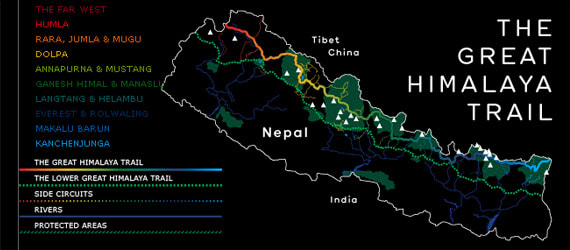
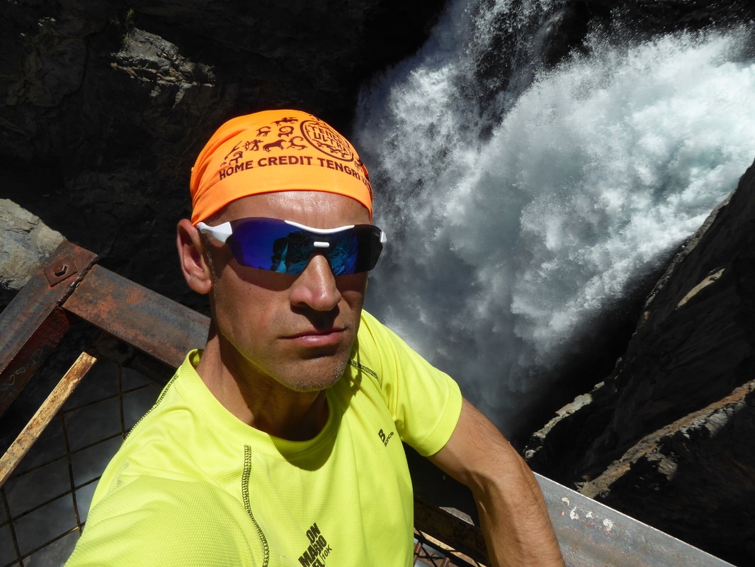
​Being a mountain enthousiast and having hiked and ran through some of the most amazing mountains on the planet I decided last year it´s time for the Nepalese Himalayas now. Browsing the internet looking for information on the GHT you soon find out there´s not much out there. The most comprehensive source of information is definitely  Robin Boustead´s www.greathimalayatrail.com   This is also the site where I got in touch with Charlie, who ended up being one of my companions on the GHT. We agreed to allow 1 more person to our team so an Australian girl joined us a bit later and together we started organizing things such as itinerary, guides where obligated, gpx files, logistics...etc... after a long search for a trekking company we decided to take MAC TREK as our partner.
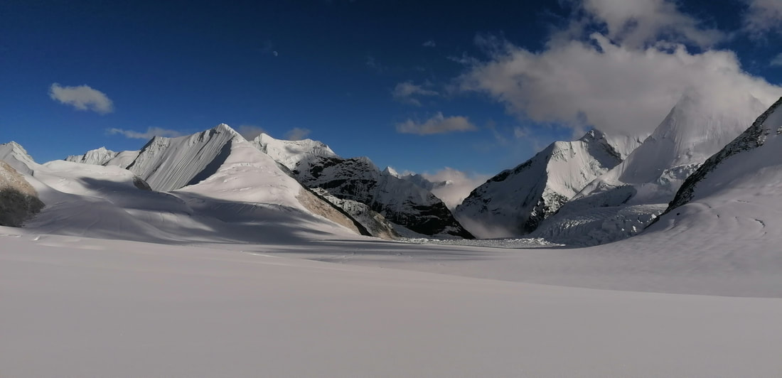
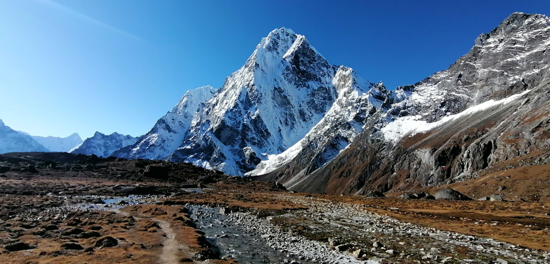
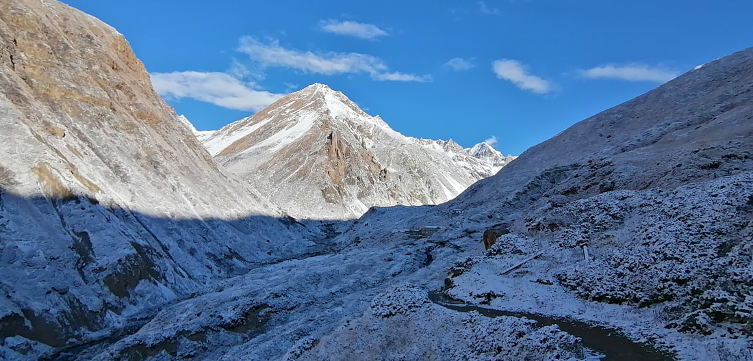
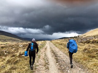
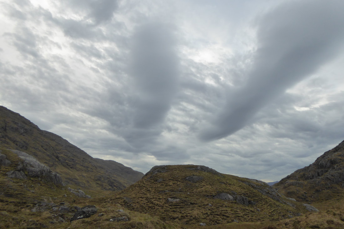
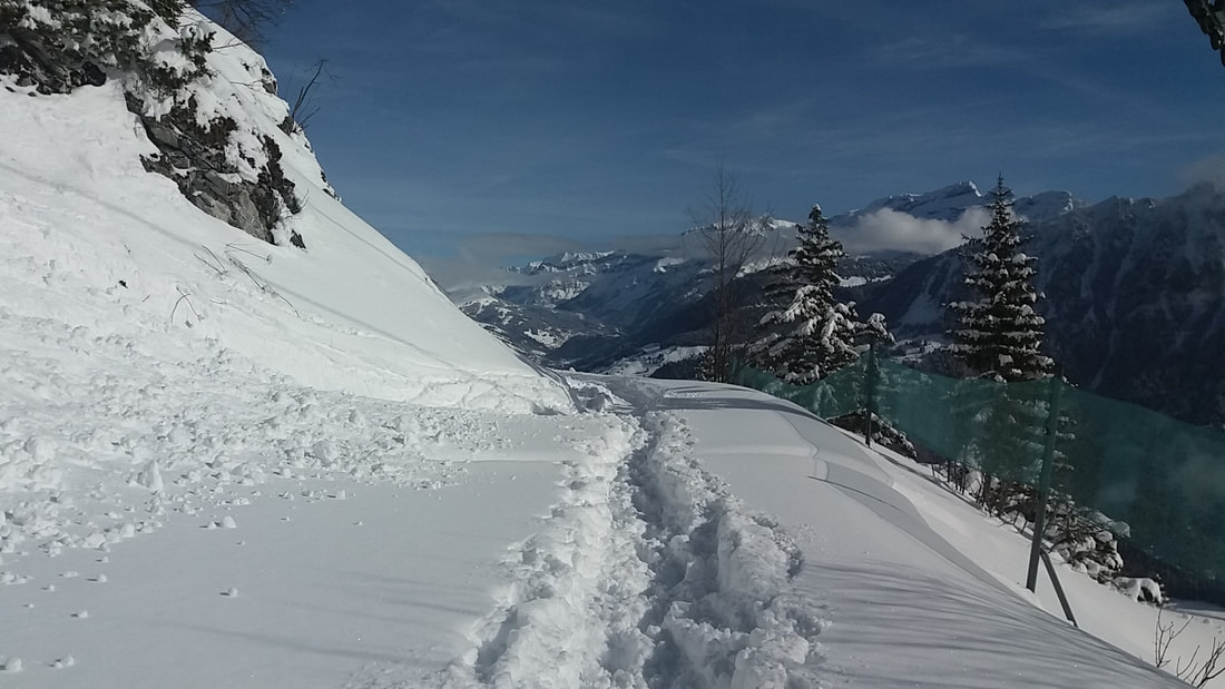
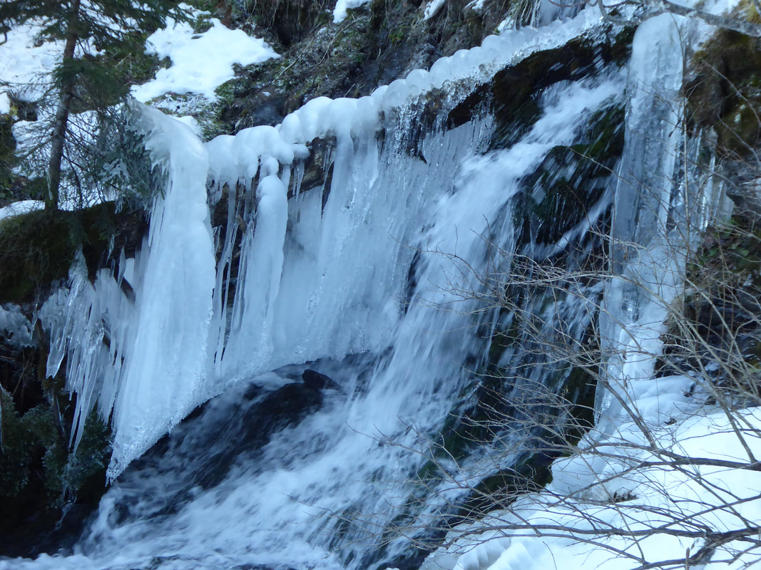
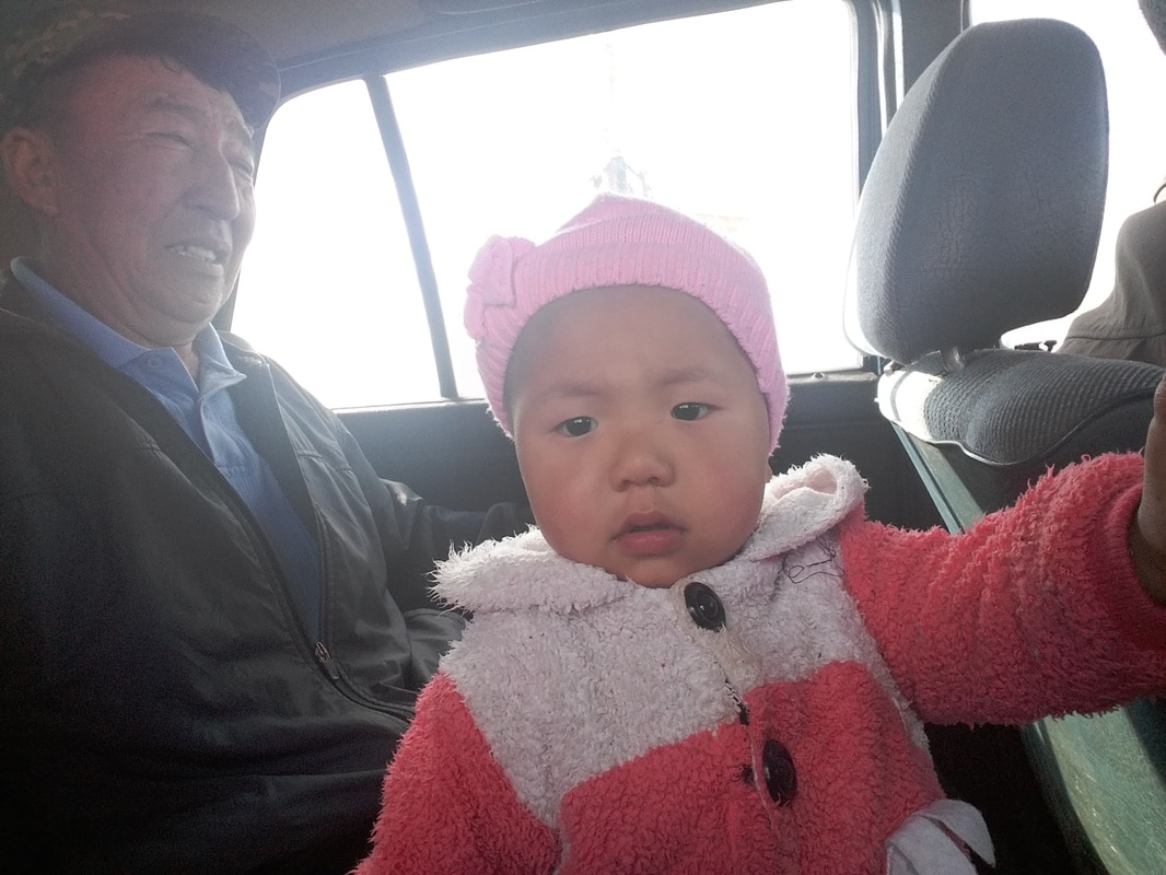
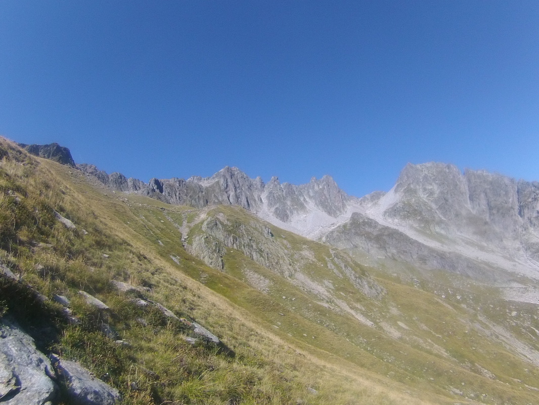
This was without doubt gonna be the most challenging undertaking I had ever done and perhaps will ever do!  so I needed to prepare myself  physically and mentally for this journey. Extensive trainings in both Switzerland and Scotland did the job and have proved to been very useful as gear and navigation tests. A few weeks before the actual start the Australian girl bailed out and Milena, a polish girl, took her place. On september 5th we all met in Kathmandu for the first time. Milena, who arrived earlier in Nepal, had bought all the climbing gear for us in KTM. After arranging our permits we left KTM for Taplejung, a village in the east of Nepal where our adventure would start. actually, the official starting point of the GHT is Kachenjunga BC, 60 km northeast of Taplejung.  On our way to the base camp Charlie was the first one to show signs of altitude sickness at around 4200m so we went back down to 4000m and spent the night there. The next day we hiked up to 4780m where Milena got a terrible headache and decided not to go up to the basecamp at 5143m with us. Charlie and I left at 4:30 next morning towards Kachenjunga BC while Milena went back down to Gunsha at 3500m where we would meet up again after a long day´s hike. This is also the place where we said goodbye to our guide ( this is one of those areas where a guide is obligatory but not realy useful as the path is obvious! ) Our next guide would be a climbing guide who´d   take us over the 3 technical passes. We were going to meet him at Makalu BC in another 10 days...at least according to our schedule. So untill then it was just the 3 of us against nature!      Next morning we left for a long hard day. After crossing a 4700m pass, many- sometimes dangerous- river crossings ( because of the heavy rain the rivers were wild ) , scrambling over fallen rocks due to landslides and hiking in the dark through difficult terrain we stumbled upon a shelter and decided to call it a day. At this point it was just Charlie and myself as Milena prefered to take things a bit slower and camp along the way.  Humidity and torrential rain are the perfect combination for leeches. We must have had about a hundred of them spread all over our bodies feasting on our blood that day, some of them where humongous! 
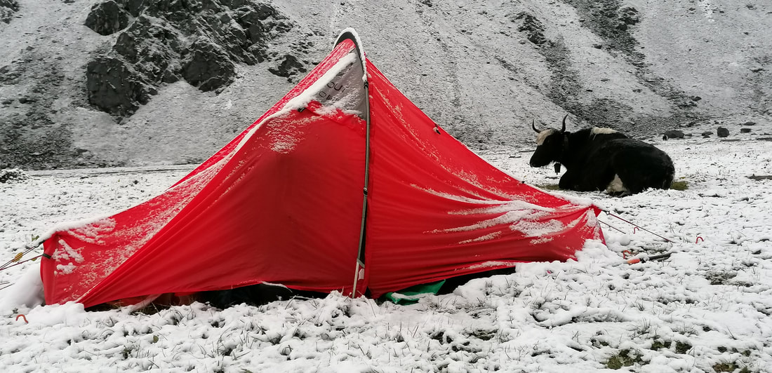
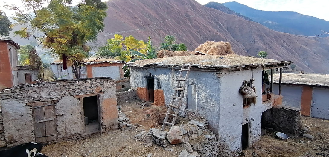
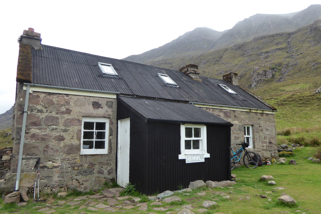
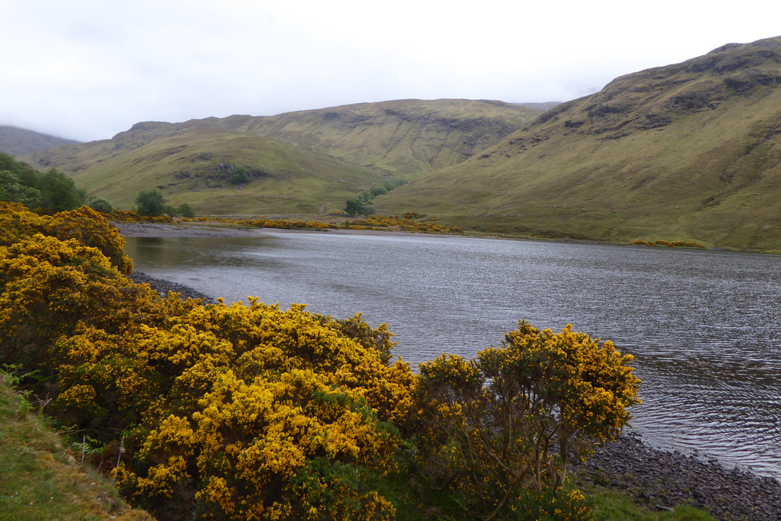
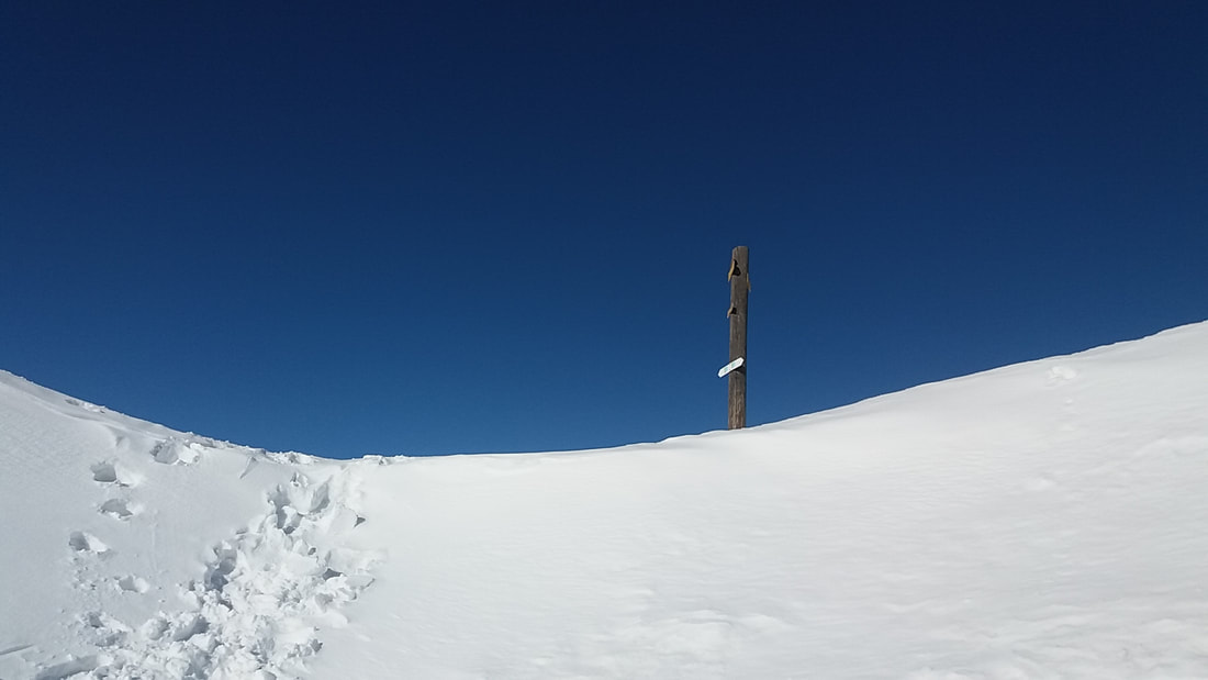
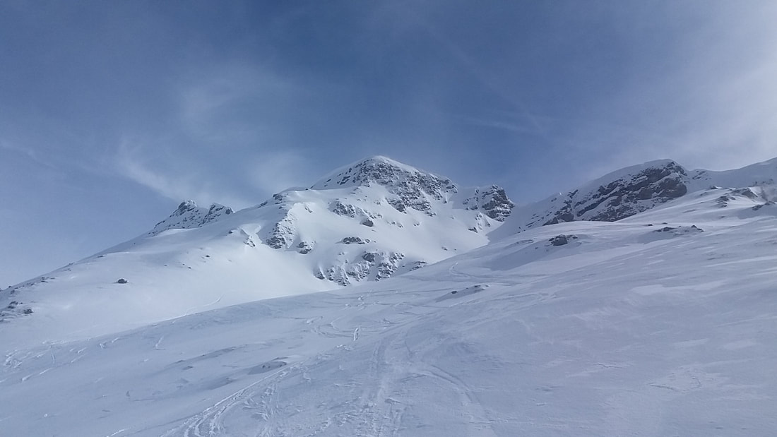
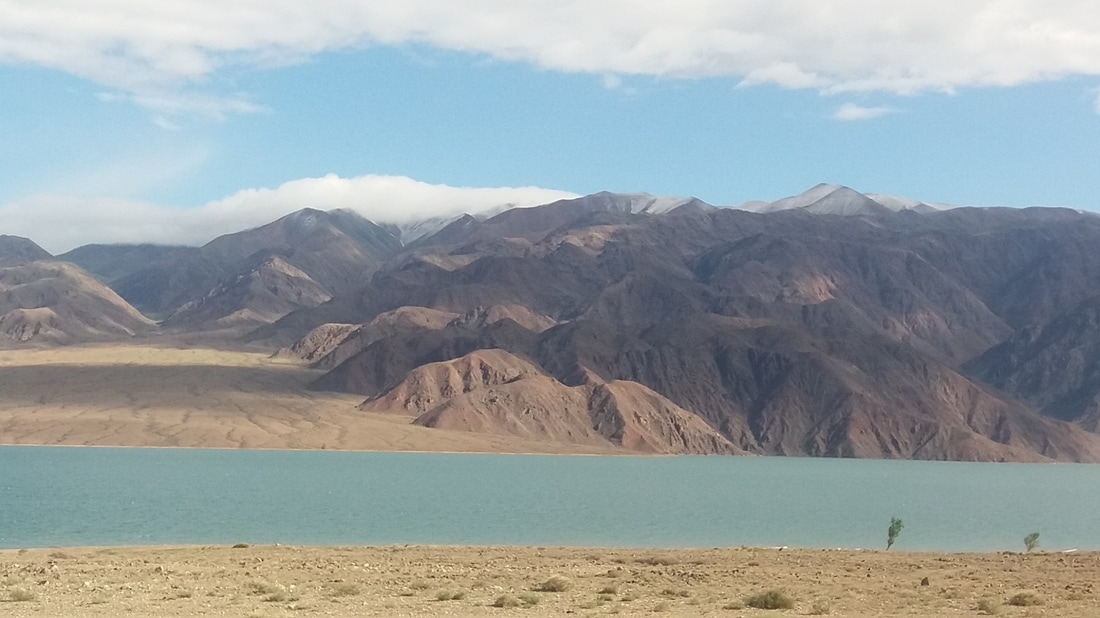
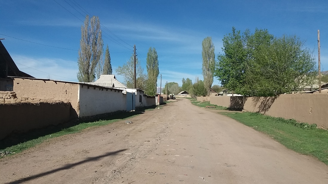
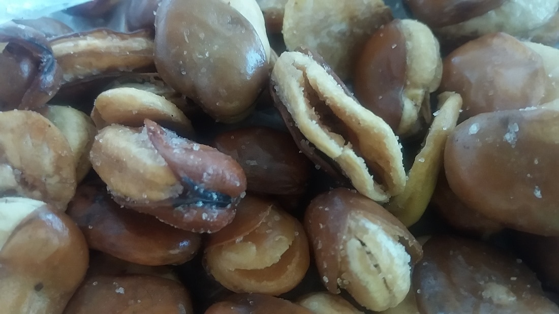
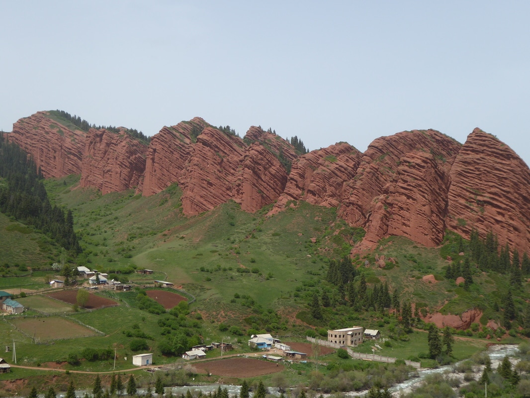
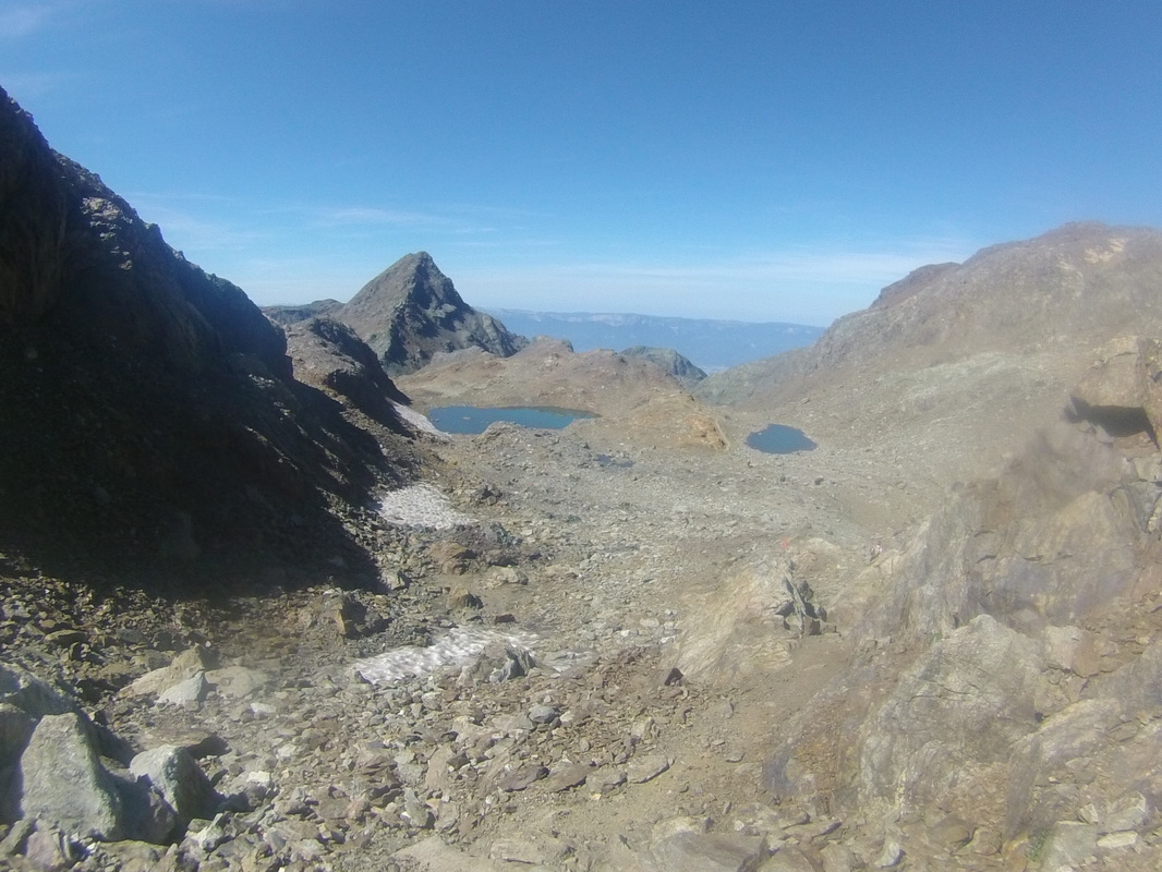
Altough short, it took us 3 hours to cover the remaining 5,5 km to the village of Olanchung Gola where we would wait for Milena which took longer than expected. Due to very bad internet connection we were not able to track Milena who was carrying the satellite phone. two days later she arrived. Apparently she´d fell into one of the rivers causing her stuff to be completely wet so we waited another day to get her stuff ´¨dry´´. Because of it´s proximity to the border people take their yaks up to there to trade with Tibetans so the shops here are stocked with cheap chinese goods. One of these items were chinese army biscuits. Although pretty heavy they were quite filling and soon became our favorite snack. Next pass was Lumba Sumba, 5160m. We spent the night at pass camp, just before the pass where we got a nice treat. Local yak herders had put up a huge tent and had a fire going. They invited us for Tibetan butter tea and yak cheese. When we woke up the whole valley was covered in snow.  
​

Picture
Picture


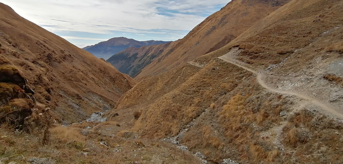
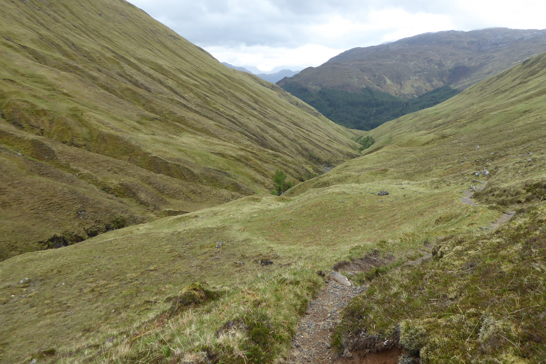
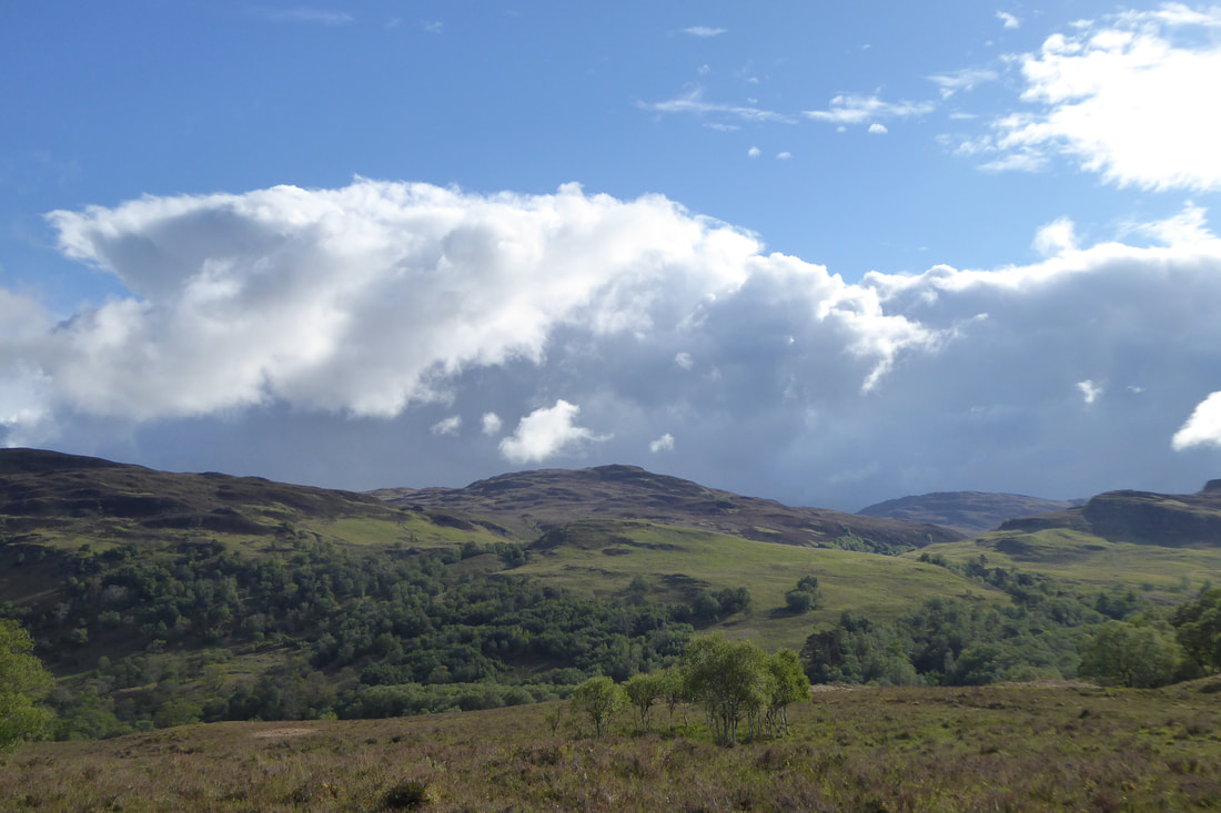
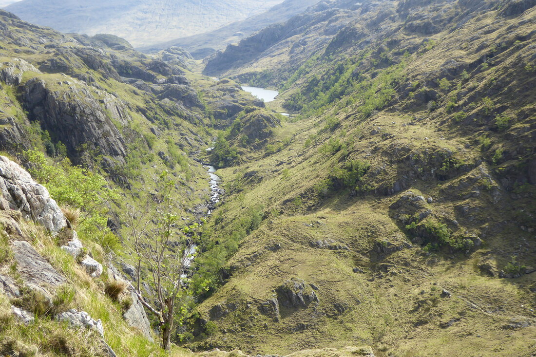
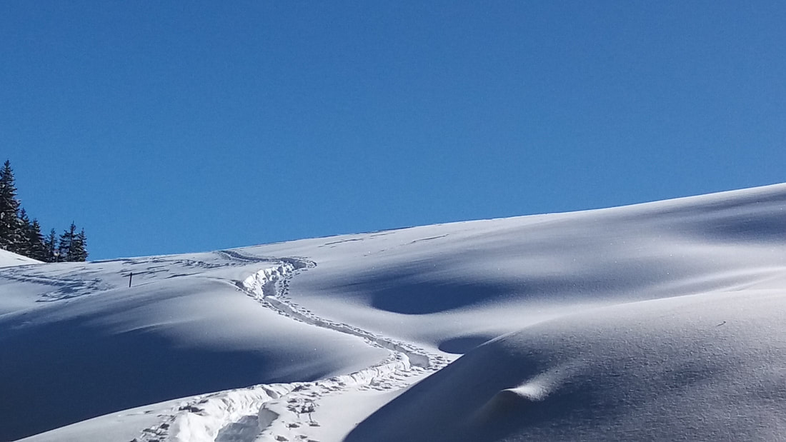
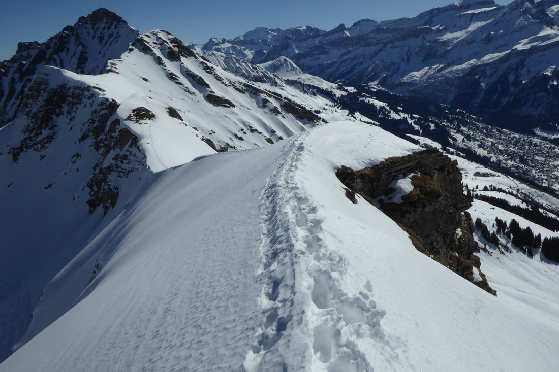
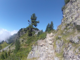
The hike over the pass seemed endless with a long descent back into the forest afterwards. I found this jungle part to be the hardest part of the GHT.  Especially in terms of navigation.  Everyone gets lost here somewhere, somehow. We did as well a couple of times but luckily not for too long. 
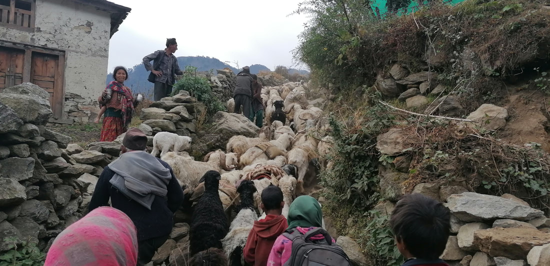
Arriving at Hongon we were heading north following the high route towards Makalu BC.  that night was probably the worst night of all! Heavy rainfall made us turn back the next morning. Every single thing got wet and we were already hiking in wet clothes for some days. We would not survive another 3 or 4 days in the cold in wet clothes and having to sleep in a wet sleeping bag so we went back and took the lower route on which we would pass through villages and had the chance to let our stuff dry. At this point we were already a week behind schedule. We followed the Makalu BC trek and for the first time since we started we saw tourists along the path. Arriving at the BC we finaly had our first day without rain and it would stay pretty much clear for the rest of the GHT.  
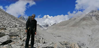
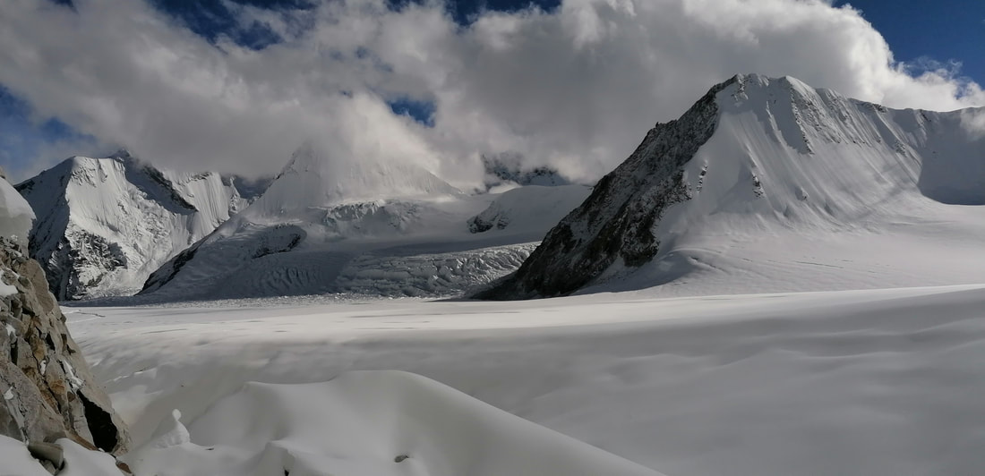
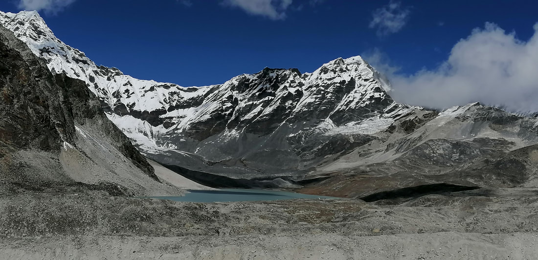
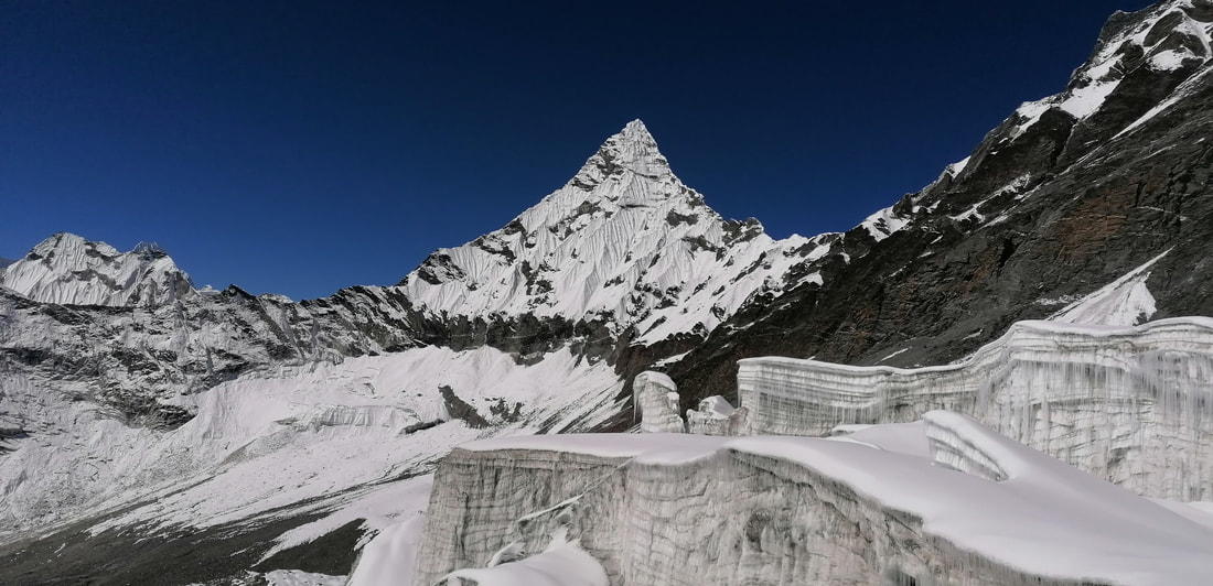
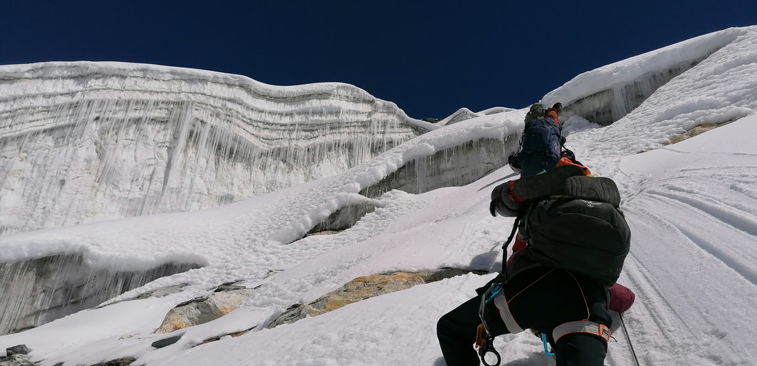
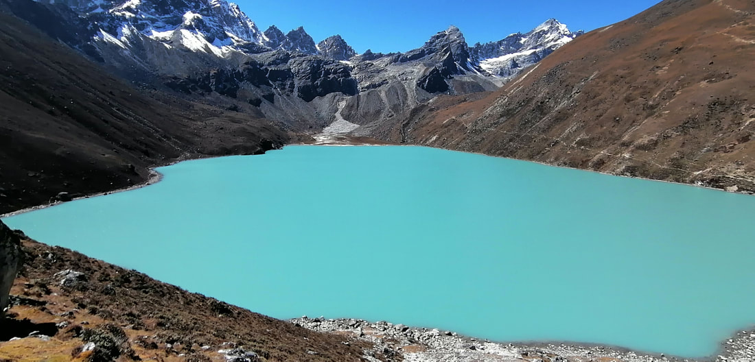
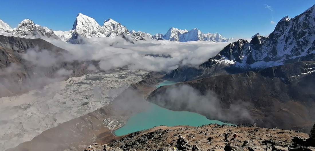
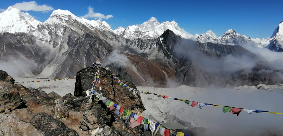
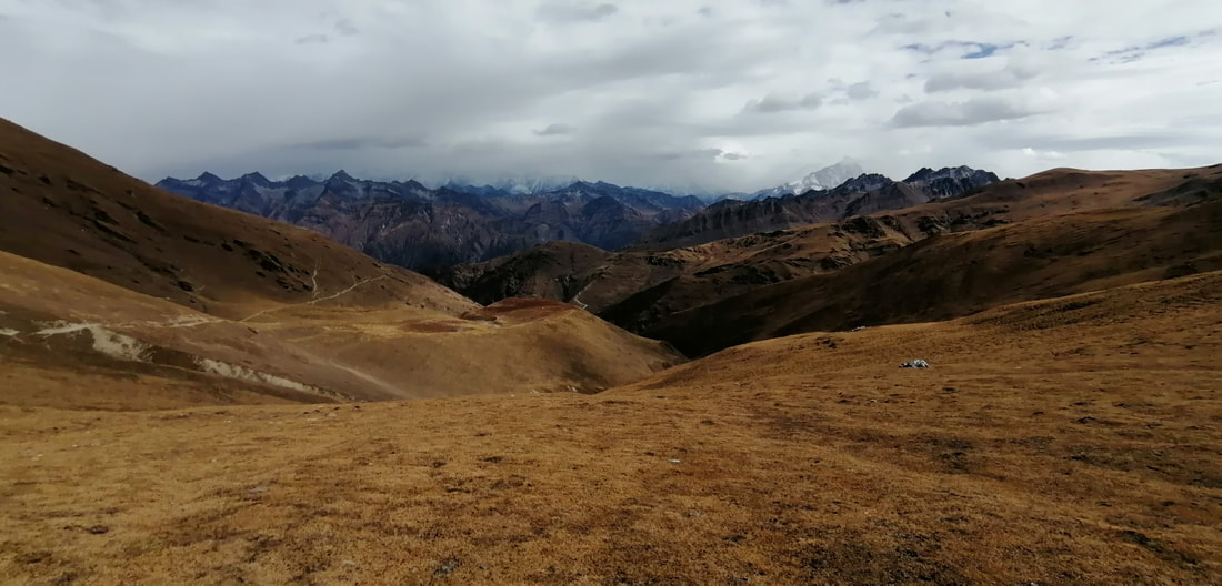
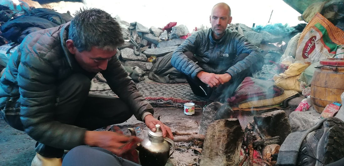
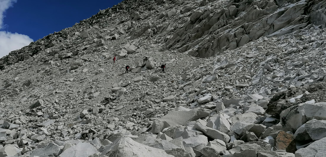
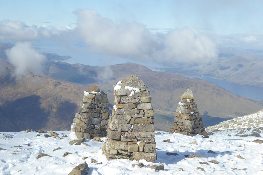
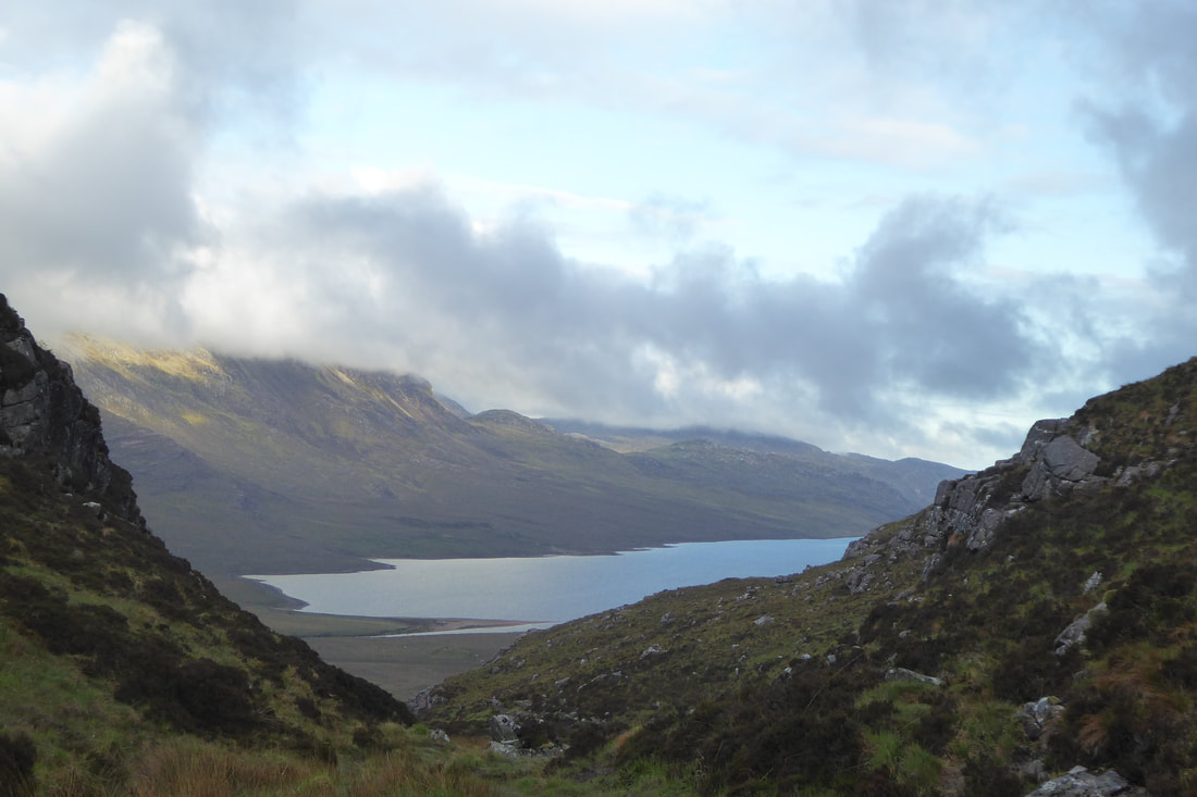
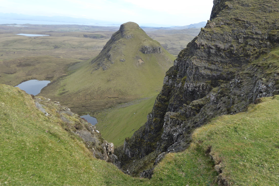
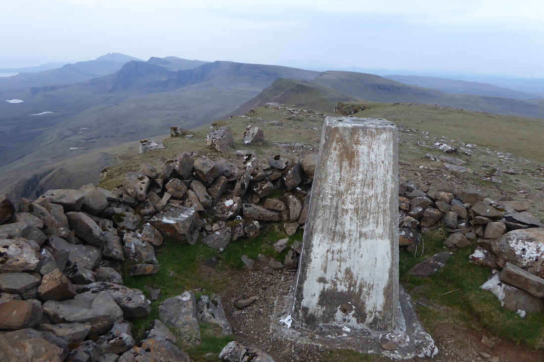
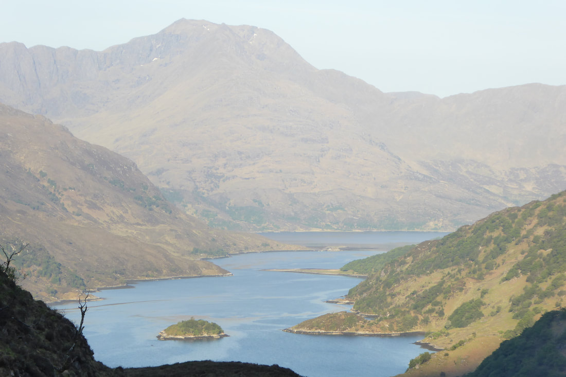
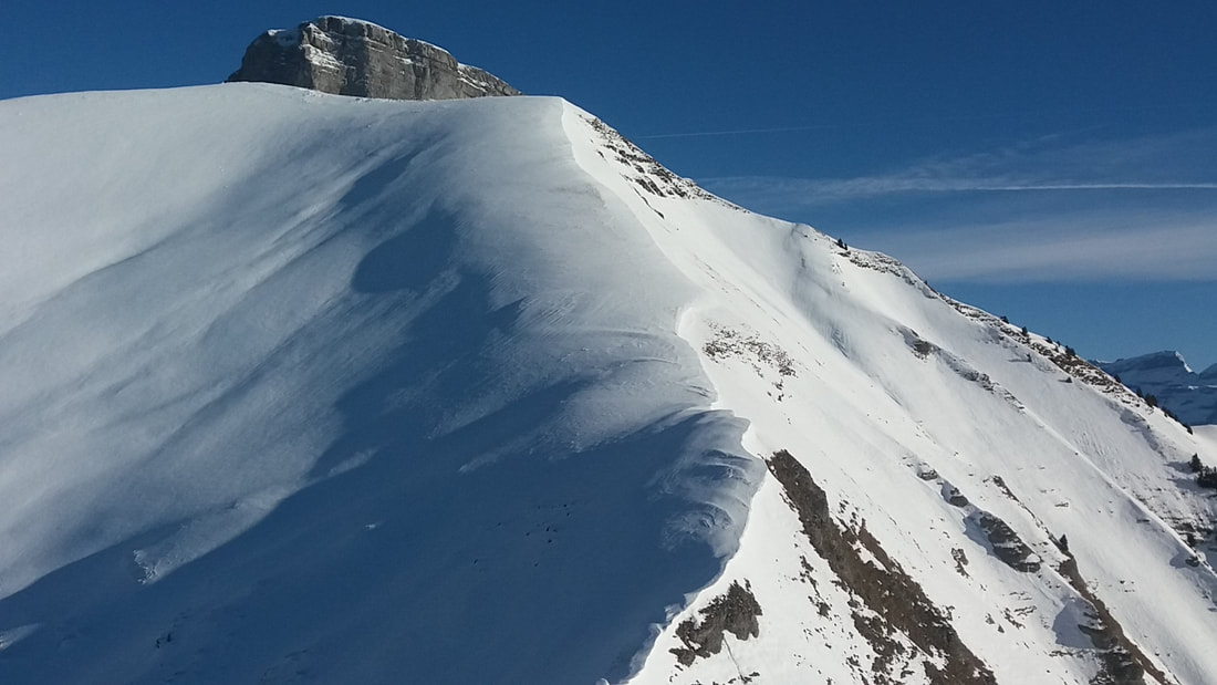
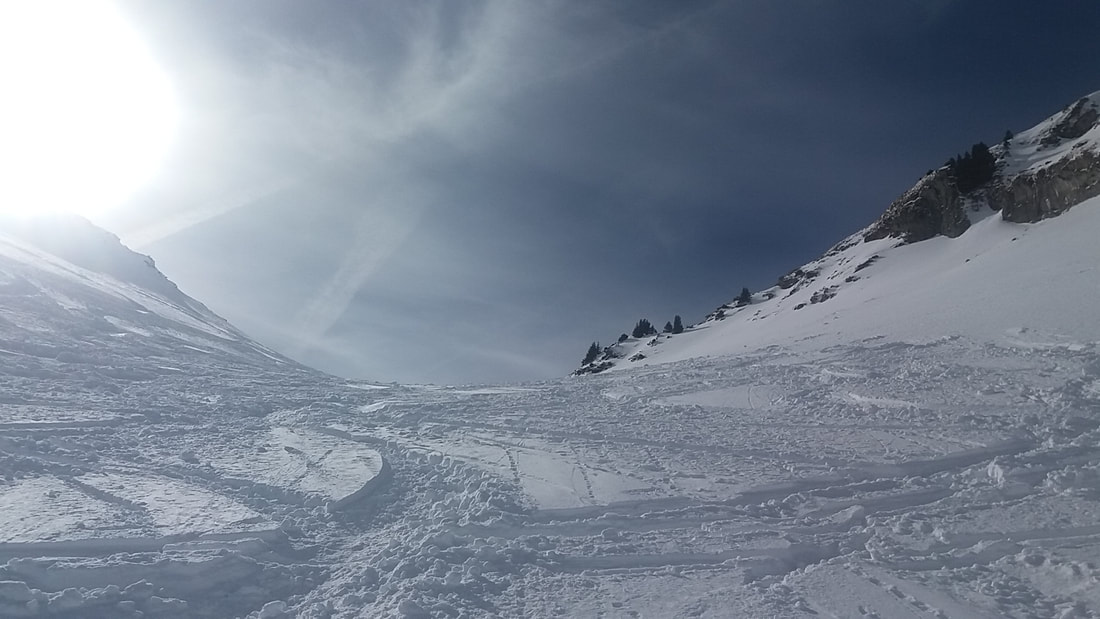
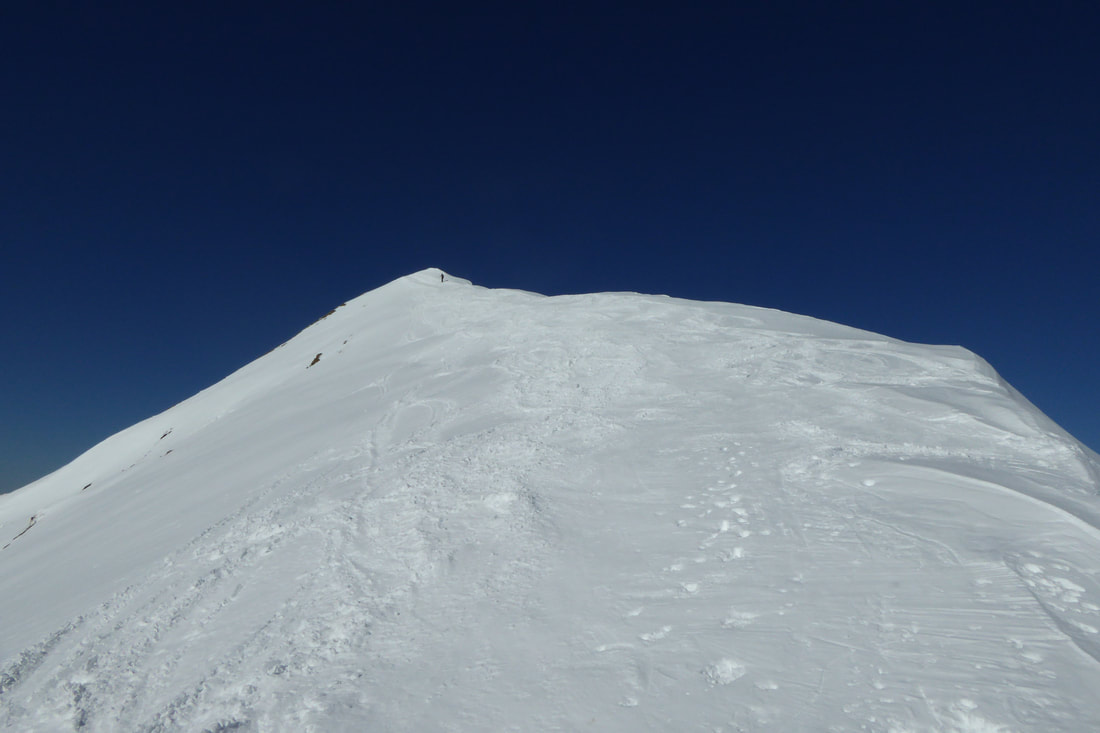
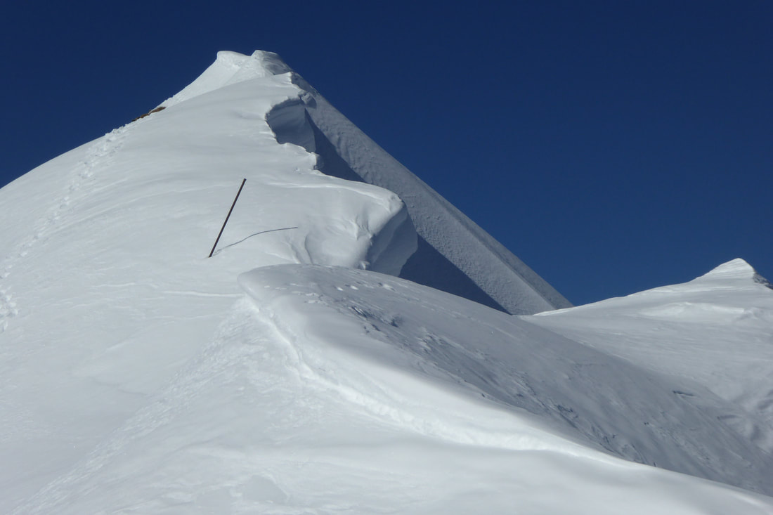
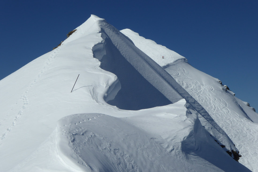
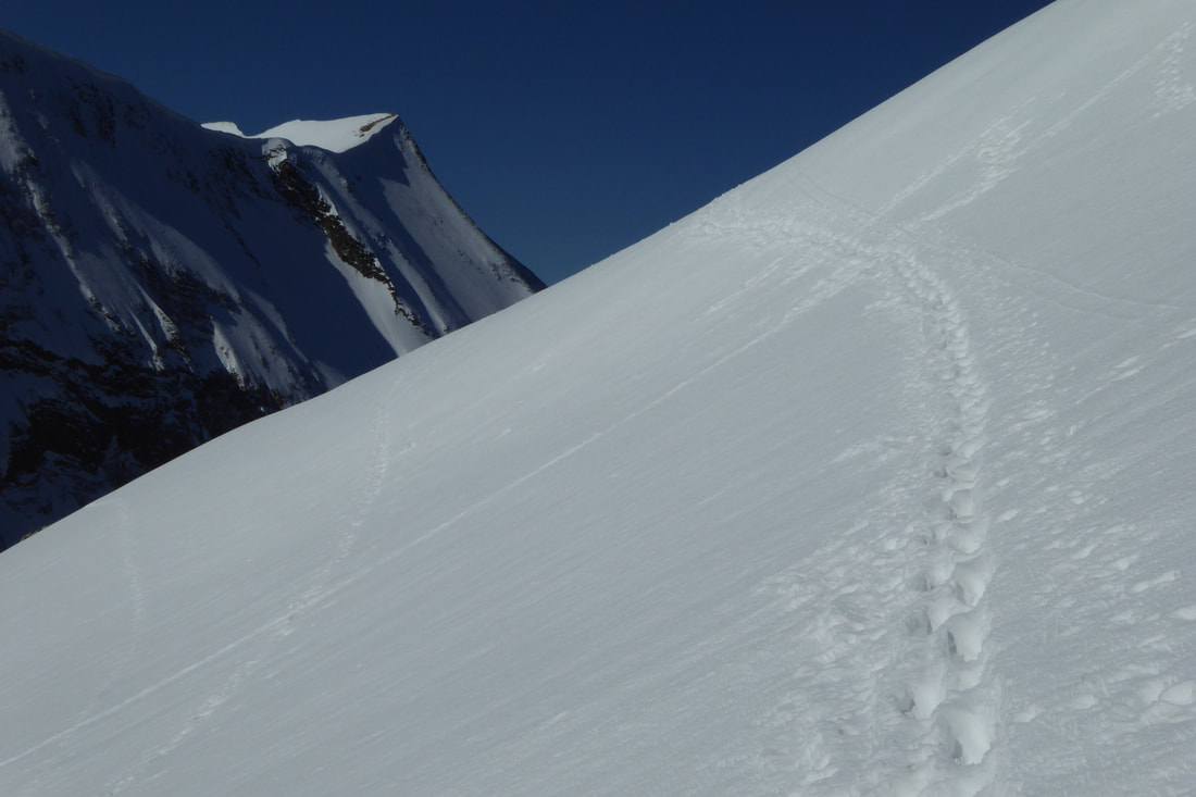
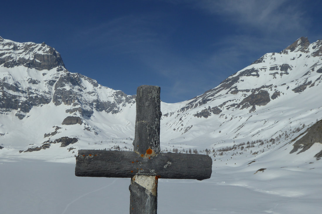
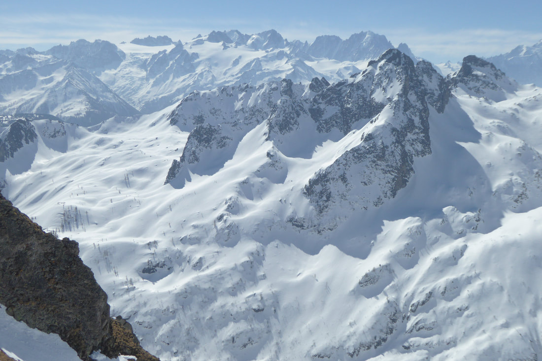
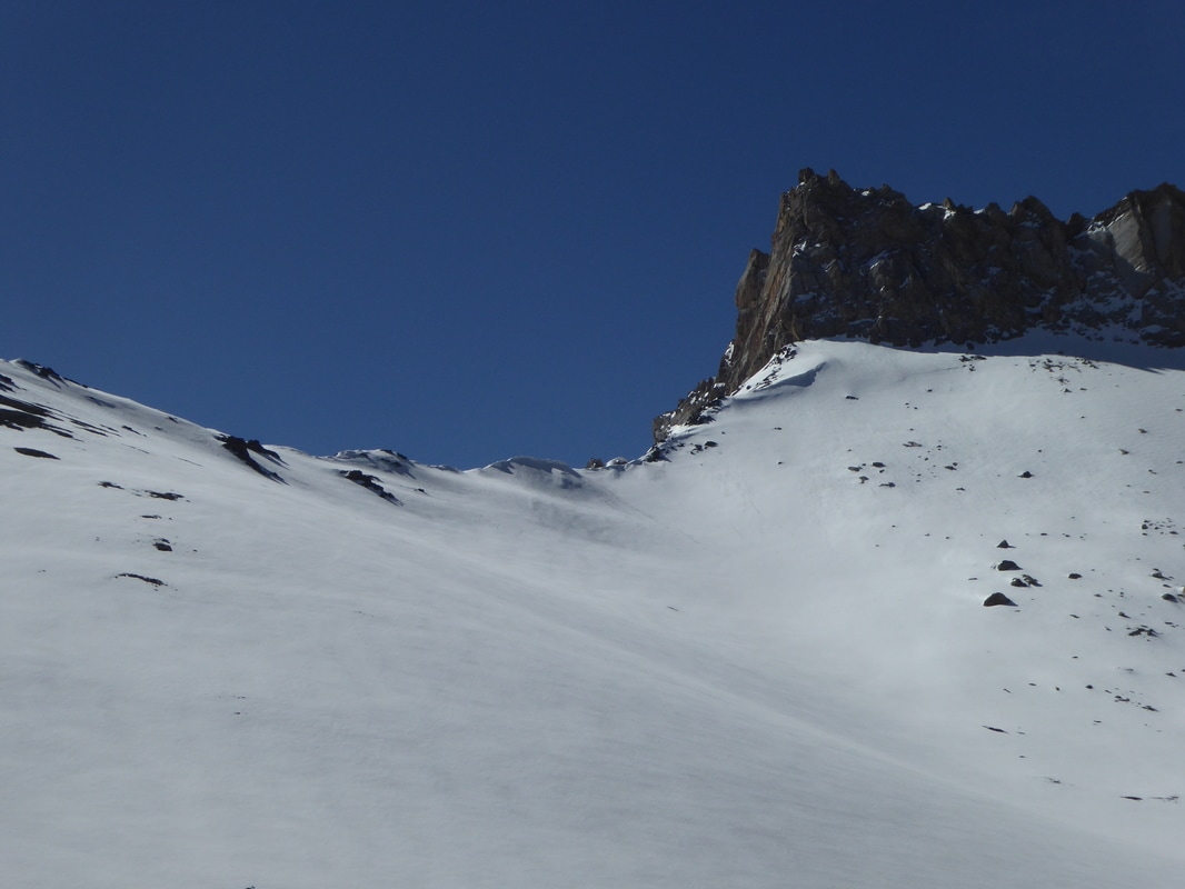
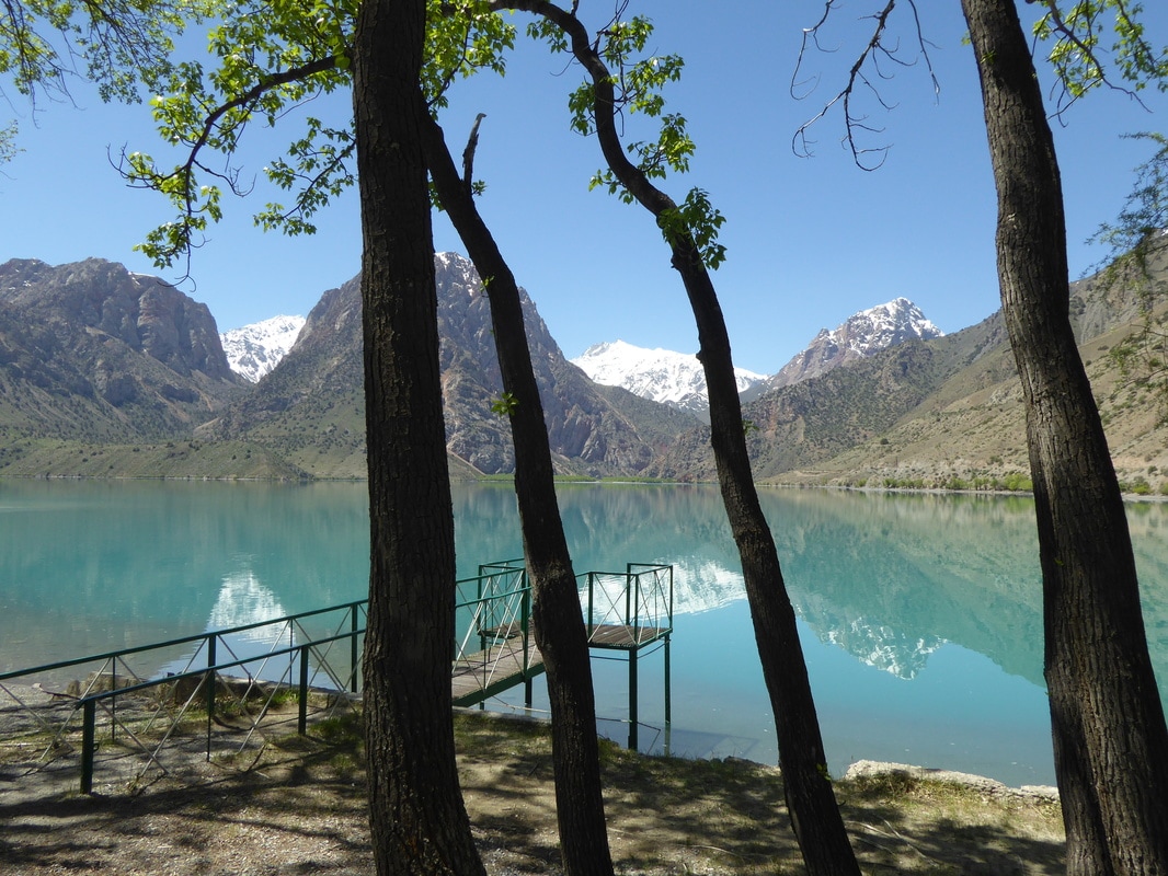
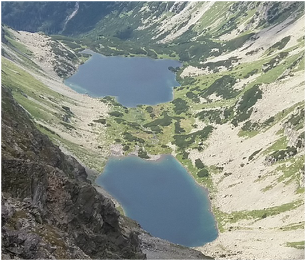
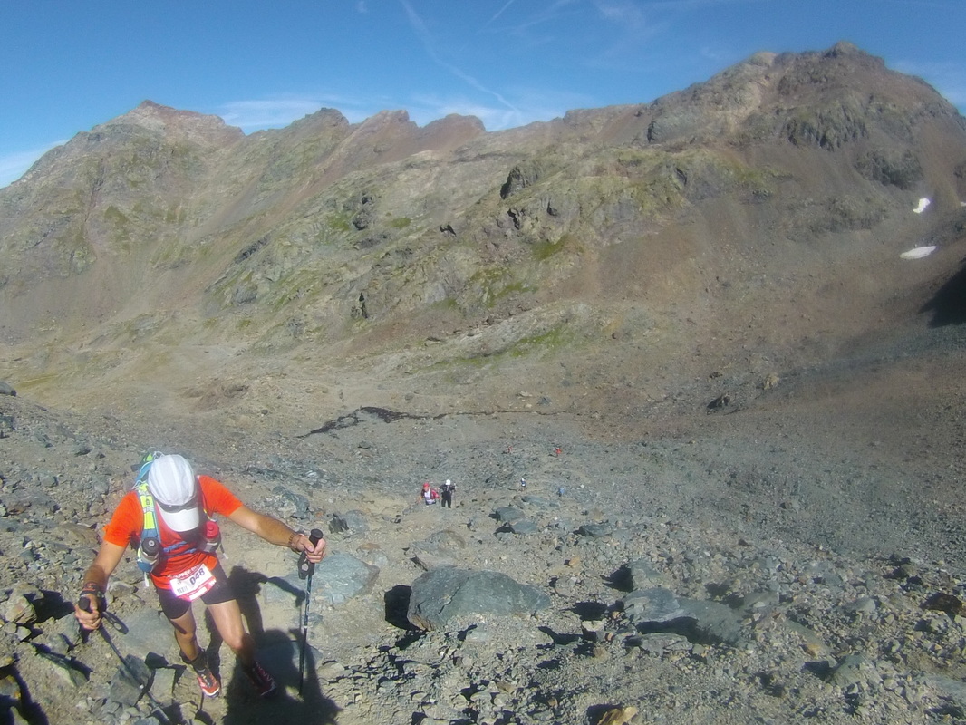
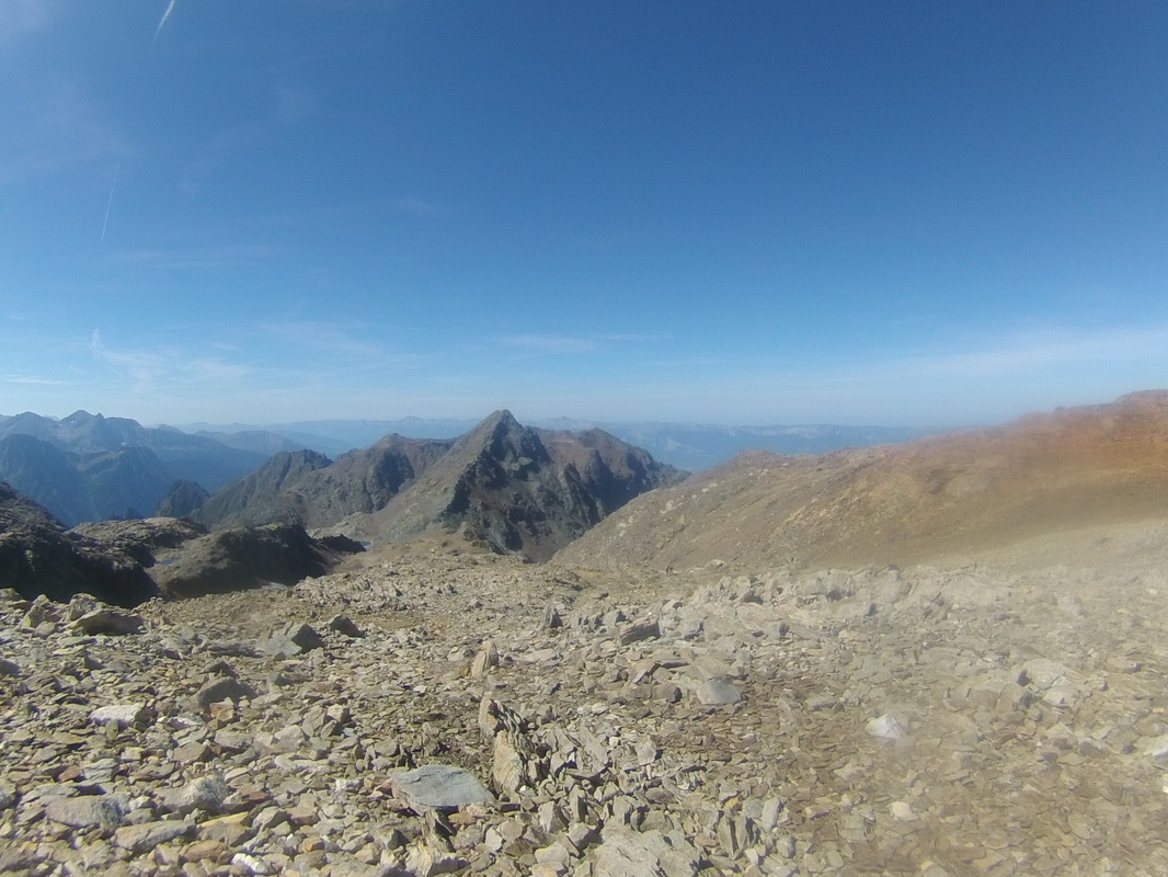
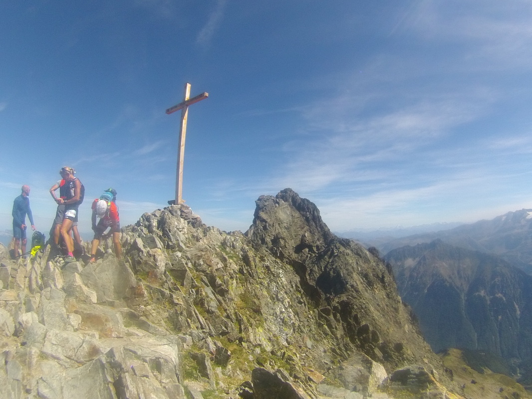
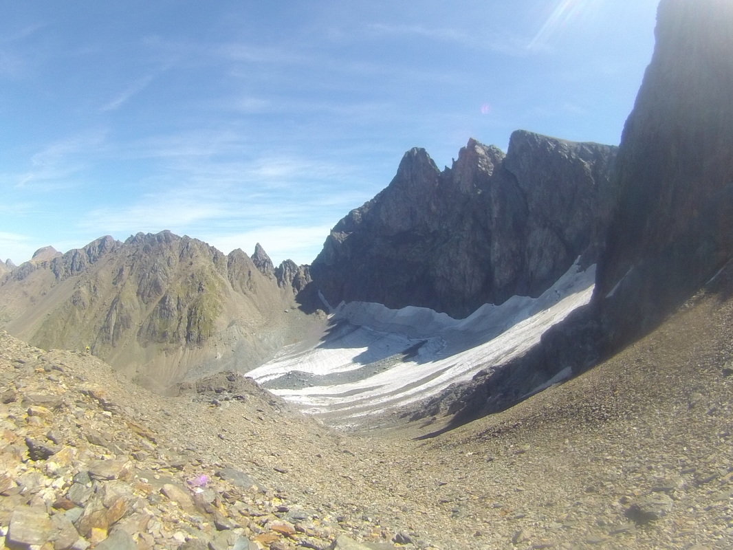
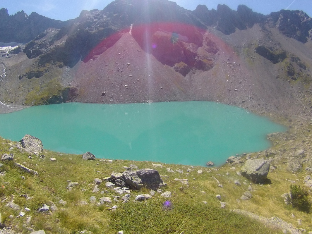
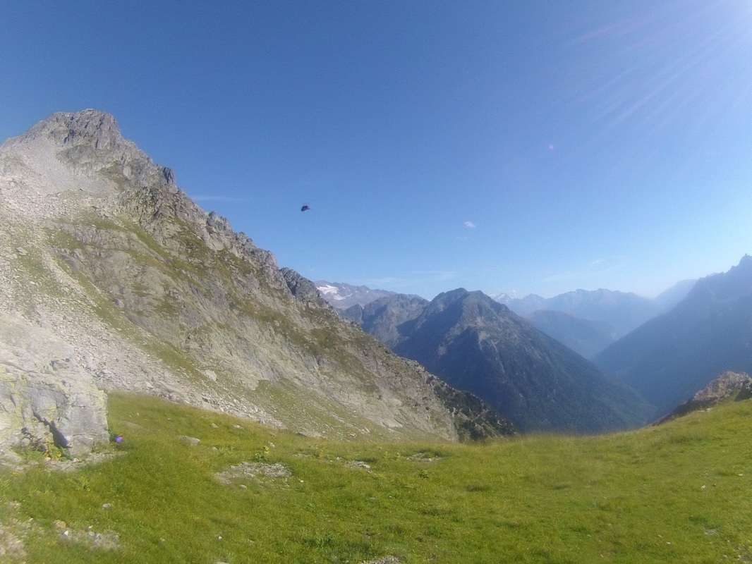
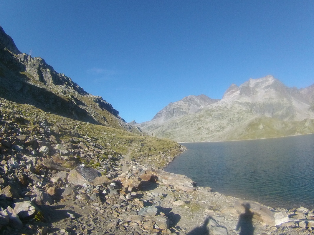
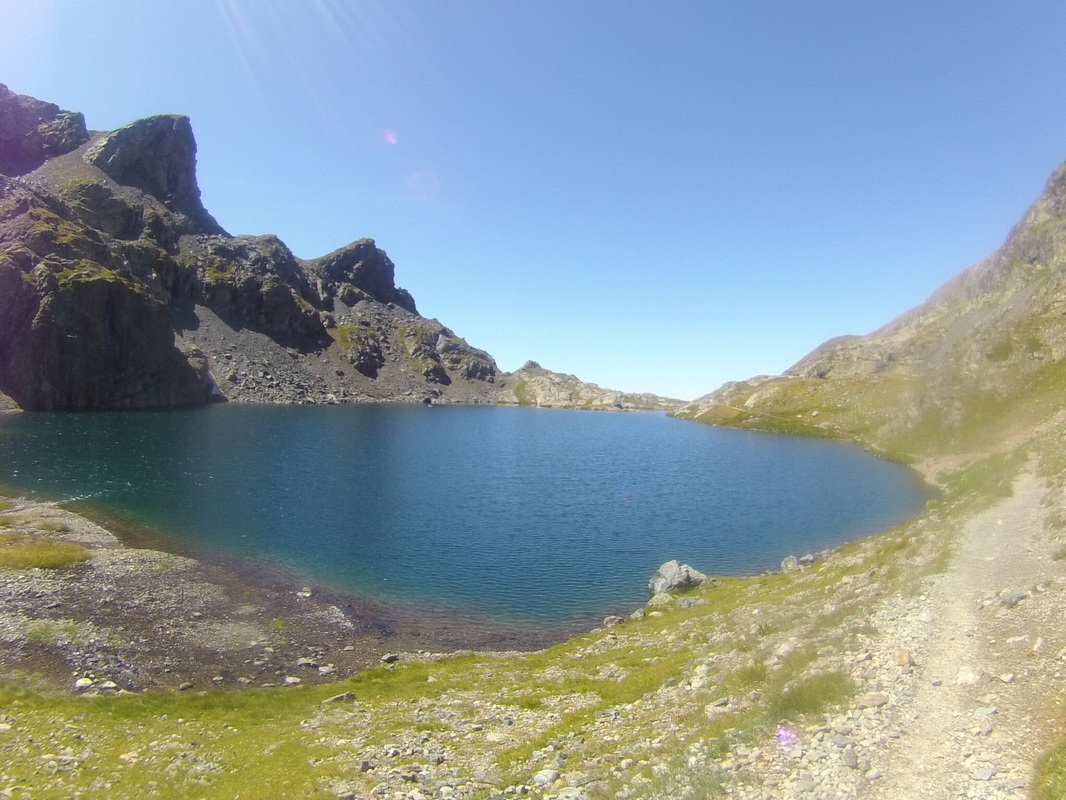
Our guide gave us a quick mountaineering course and the next morning we headed for what is probably the highlight of the entire GHT : The 3 technical passes, Sherpani col at 6146m, west col at 6143m and Amphu labsta at 5848m. We skipped Swiss camp and went straight to sherpani col base camp at 5688m. Charlie´s body didn´t think that was a good idea! he got a terrible headache and threw up several times. He took some medicine and tried to get some sleep. Next morning he felt better so we continued over the passes.  I was surprised I never had any serious issues with altitude sickness myself since we had no proper acclimatisation. We were very lucky with the weather, as we heard several people had to turn back or needed to be rescued by helicopter because of extremely bad weather at these passes this season. These passes are actually the gateway into the Everest region.  The hike over the passes was incredible but the nights were terrible for me. I´m a very light sleeper so I would just be awake most of the nights  because of the freezing cold. 2 days later we arrived in Dingboche where we took a rest day. From here Charlie took a slightly different route to Namche bazaar because he had no interest in Gokyo lake. Milena and myself realy wanted to include Gokyo. This lovely lake was probably my favorite part of the trip. 

​
3 days later we all met again in Thame. There have been some disagreements about our current pace so we would discuss in Thame how we would go on from there. Since I´m the only one with a tight timeframe I thought we were going too slow so I decided to continue at my own pace. Charlie still wanted to do 1 more technical pass, so was Milena but at a slower pace so we each ended up going our own way from here.
I left that morning taking the lower route towards Kathmandu where I wanted to change to my smaller backpack and into my running gear but the next day I got a message from Mac trek saying that Milena had an accident and she´s not with us anymore. She fell off a 200m cliff. I was shocked! We could not get in touch with Charlie because there was no signal in the high mountains.
When he got the news he came to KTM right away.
We spent 5 days in the capital arranging stuff.
The plan was to continue together untill Gorkha and see from there. We were doing long days covering 45km a day. 
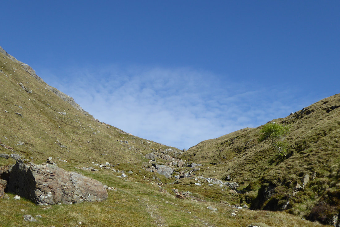
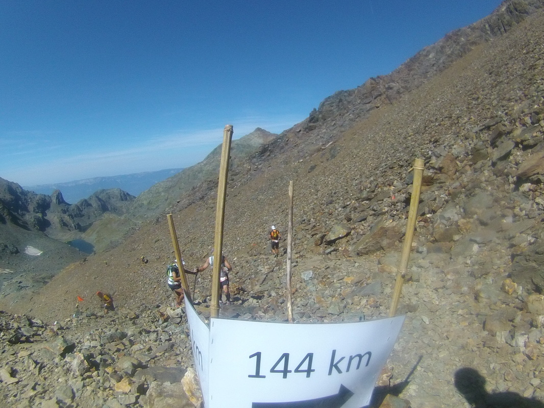
In Gorkha we had the best applepie ever! it was huge...a full meal on its own actually. Here we also decided to split up, Charlie going slow through Annapurna and myself starting to run like crazy. I had about 20 days left to finish the remaining part. I could not afford to loose much more time if I still wanted to make it on time. At one point I had to turn back from a mountain pass because of bad weather and backtrack for 2 days. I then continued through the lower mountains for a bit and back up to Rara lake, Nepal´s largest lake. I had not any means of navigations on me so I just had to rely on my instinct and the help of the locals. Which turned out not too bad actually. 5 days later I arrived in Darchula, the other end of the Great Himalaya Trail! the last part I forced it a bit and kept going for 30 hours. It was a very emotional moment for sure. Hard to describe how I felt at that moment...and the following days!
One last important thing I want to add to this for those interested in the GHT: Come prepared and don´t underestimate it!!! 
​
​Facts:
-1600 km in 70 days with more than 100.000m of altitude gain through different environments: from jungle over high passes and into the ( in Nepalese terms ) lower mountains.
Highest point 6164m lowest point around 800m.
-Being a vegetarian I had no problems at all in the higher regions but once on the lower route most of the dishes contained chicken. 
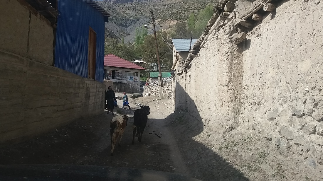
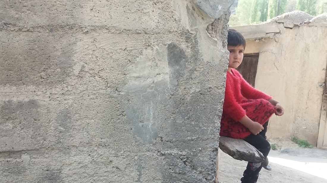
-There was always at least 1 person who spoke enough english in the remote villages.
-Kachenjunga was probably the cheapest and Everest the most expensive area.
-Nepal is a very safe country. People have been very friendly and helpful everywhere. 
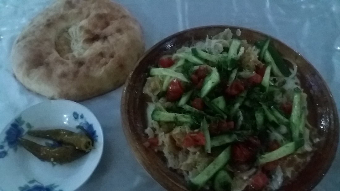
-Dal bhat, the national dish of Nepal. Some are very tasty ones,  some very plain and tasteless I´d say...
But you´ll have one nearly every day. :-) 


0 Comments

GHT preparation pt 2

5/31/2019

1 Comment

 
Picture
A week after having spent four and a half months in Switserland I was all packed and ready to leave on my next journey. While in Switserland I was mainly working, but also had lots of opportunities to go into the mountains to run , this trip I could realy focus on preparing for Nepal. My objectives were to spend long days on the trails with a rather big backpack, testing my rain gear, solar powered charger ( maybe I was a bit too optimistic bringing it to Scotland, where it rains most of the time. :-)  )  amount of food I would need for at least 3 or 4 days...etc. 
Upon arrival in Glasgow I went on to the startingpoint of the West Highland way (150 km), which was the first of the three long distance hikes I had planned on hiking in 4 weeks time. This is also the only one that is marked and is considered an official hike. Paths are always clear, and there´s plenty of accomodation and food options along the way.
I hiked for just a few hours and put up my tent at a riverside. One of those lovely things about Scotland: Because of their `right to roam` one is allowed to walk just about anywhere and camp wild as long as you behave responsibly. 
The next day I got up early ( as I would every day actually ) and started my first full day on the trail. It was a quiet easy day as the trail was mainly flat mostly going through woods dotted with flowers. From day 3 the landscape started to get a bit rougher. on my 4th and  last day I met 2 Scotts who were going quiet fast as well so we stayed together untill the end of the hike. We had good laughs and bad weather on the way, even a hailstorm.  That same evening in Fort William we went for dinner and a drink at the pub to celebrate our accomplishment. The next morning I walked up to Ben Nevis, the highest mountain in Great Brittain. Which is ofcourse peanuts compared to Nepal. It was a straightforward walk, just a bit tricky coming down in the snow. 
​

Picture
Picture
The plan now was to start with Cape wrath trail untill I was close enough to Isle of Skye and make a detour to hike that trail first and continue Cape wrath later on. The first day was not that spectacular but from Glenfinnan ( famous for it´s ´Harry potter´ viaduct ) the scenery got more and more impressive all the way to Cape Wrath actually! On day 3 I arrived at Shielbridge from where I would hichhike to Isle of Skye. A bit later I arrived at Portree, the biggest town on the island, checked in into a hostel, got some laundry done and had myself a good meal. The next morning I took a bus to the starting point of the Skye trail (130 km) Starting off following the coastline before heading up to the spectacular Trotternish ridge. A 36-km-long stretch of beautiful rock formations and steep cliffs. it was also a very hard sections going up and down constantly. Just before dawn I found myself a wonderful campingspot on the edge of a cliff.   

Click here to edit.
Picture
Coming back down from the mountains the path continued along the coast for about 34 km and next through a beautiful valley untill it reached a peaceful bay with a wonderful bothy. ( kind of a very basic, free mountainhut ) That´s another of those great things about Scotland. They´re mostly located in remote and beautiful places and often at a lakeside. 
The next day I finished the rest of the trail and hichhiked back to the place I interrupted Cape Wrath trail 5 days ago.
​

Picture
The further north I went the more impressive the landscape and the stronger the sense of remoteness, but the trail also became more and more boggy and pathless which, in combination with bad weather, made it hard to navigate. Because of the heavy rain of the past days the paths ( if there were any ) had turned into streams and rivers nearly impassable. With great care I managed to cross them, but not without risk. At one point I slipped and most of my gear got wet and would not dry before I finished and got to a hostel where I could dry my stuff. 
To make things worse all my batteries went dead and my solar charger was not charged because of the absence of sunshine so no more GPS track and I had no map. I just had to rely on my compass and my instinct now. Which turned out well actually. Good thing I was not too far from the end. Cape Wrath lighthouse came in sight after 9 days on the trail. 
Without any doubt, this 380 km long trail was my favorite one! It had everything I´d expected from it! 
Overview of my gear test:
- New rain jacket was perfect but too thin for Nepal.
- Rain trousers worked well
- solar charger has not been tested well enough because of the lack of sunshine.
- (cheap) Sleeping bag and liner were not warm enough, even for Scotland. 
- hikingboots not waterproof (anymore)
- As my back was the only bodypart that was suffering I will have to do some extra training to strenghten my back before going to Nepal.

​


​
1 Comment

GHT preparation pt1

4/23/2019

0 Comments

 
I´m nearly at the end of my Swiss adventure. I´ve been here more than 4 months now. Partly working and partly training for Nepal. Altitude wise it´s nothing compared to Nepal but I did have  some tough trainings. Steep ascends, mountain passes, deep snow and freezing temperatures.  Now it´s time for a short break before my next challenge in Scotland.  Those interested in helping to fund my good cause... https://www.facebook.com/luc.ght.3?epa=SEARCH_BOX
Thank you for any help you can offer. Remember...It´s only a small snack for you but it means a big deal to them. :-) 
​
0 Comments

GHT...The ultimate trail

2/25/2019

0 Comments

 
Picture
It´s time for my next adventure...
This one will be my biggest challenge so far.
The great himalaya trail! crossing Nepal from east to west ( or vica versa ) with a distance of approx 1600 km and, depending on the exact route, between 55.000 and 90.000 m of altitude gain. 
The plan is to finish within 60 to 80 days. 
It´s not an actual trail but more a collection of different trails glued together with several options along the way.
I will be following the high route but skipping the few technical passes that require special equipment as I want to travel light and fast.
Starting mid september in Kanchenjunga, east Nepal and end up in Hilsa, west Nepal approx 2 months later. 
I will also raise money for charity. Cunina, a Belgian ngo that build schools for kids in remote areas of Nepal ( as well as other countries ). Obviously I chose to support a project in Nepal itself. More details regarding sponsorship will be posted shortly. 
I will also be posting further developments of my preparations.
At the moment I´m working and training in Switzerland untill the end of april. In may Scotland.
​


0 Comments

Central Asia

5/26/2017

0 Comments

 
  This part of the world has been high on my bucketlist for a while, as well was this race 'Tengri ultra' in Kazakhstan. I only had about 3 weeks so I had to make a choice on which countries to pick. I decided on Kazakhstan, Kyrgystan and Tajikistan. So here's my story.
1) Kazakhstan: the biggest of them all. about 90 times the size of Belgium but only twice as many inhabitants. 1 euro= 345 tenge.
The main reason for this whole trip was this small scale ultra race called tengri ultra, named after khan Tengri, with 7010 meters Kazakhstan's highest mountain. Last year it had only about 30 participants for the 70k, this year it saw a threefold increase in the number of racers. I had finished Madeira Island ultra trail only 2 weeks before this race so I was not planning on doing much of running the days prior to the day of the race. On my way to Kazakhstan I had a 4 day stop over in Kiev, Ukraine. a pleasant city. I had a 4-hour run here. In Almaty I had a 1-hour run with a Ukranian friend of mine and one up to kok tobe hill with good views of the city and the surrounding mountains. In these mountains I went to the big almaty lake, despite what its name may suggest it's not actually that big (pic)! I also went to see the ski resort and the world's highest ice skating ring here. 
On saturday at 1pm it was time to leave to Tamgaly Tas, a unesco site, about 100km north of Almaty, where the race would take place on sunday. The organisation had arranged busses that would take us, runners, to the remote starting place. No facilities here! everything was brought in from the city. A whole Campsite was set up for the event. A truck served as a water station (picture). The only place where you could wash after the race was the river. The meals they provided were disappointingly small but apart from that I had no complaints! :)  A few days before the race I even got a mail from the organisation asking me if I wanted to be "a hero" in their 2017 promotional video??? hahaha...I thought that was funny, but I was also flattered! I told them I was not a hero but I would love to do it. So when we arrived at the venue they interviewed me and during the race I was filmed. I felt like an elite runner for a while! :)  ...but that feeling didn't last long...halfway the race I was still doing quite wel and ran in 6th or 7th position. but the second half of the race my leg was preventing me from going any faster and I had to slow down. Even at the flat sections. In the 5km-long canyon close to the end at least 6 or 7 people past me. But at least not a DNF! and a 15th place is not THAT bad...I guess...
2) Tajikistan: unemployment rate is 2.5% while in Belgium it's 8.8% but they make 60% more babies. :) 1 euro=9.8 somoni
The day after the race I took a flight to Dushanbe, the capital of Tajikistan. I heard about their national (vegetarian) dish called qurutob (pic) which was of course the first thing I had upon arrival. It was sooooo good! by far the best meal I had during the whole trip. I ate it at least 3 times. ( not on the same day though)  The next morning I left for the Fann mountains. My plan was to hike all the way to Iskander kul. A lake named after Alexander the great. It's described as a 4 to 5 day hike. I took a shared taxi towards Penjikent and got of at Shurcha village and took another shared taxi to artuch.  The driver dropped me at the alpine camp from where I would start to hike. I arrived at 2pm so I had about 6 hours before it would start to get dark and colder.  I went up to lake Czukurak first before heading to Kulikalon lake, where I would spend the night. Not a bad place either, but it was still too early to call it a day. I arrived just in time to enjoy the lake a bit and set up my tent before the sun was about to set and the temperature suddenly dropped. It was freezing cold but my sleeping bag kept me warm. That night I was woken up by avalanches several times. 
The next morning I had an eariy start. My tent was still frozen but I had no time to wait for it to dry. I had a long day ahead of me where I had to cross the Alaudin pass at 3850m to get to my next destination, alaudin lakes. on my lunchbreak I witnessed another avalanche.going up the pass there was still a lot of snow. sometimes I went in up to my waist and nearly lost my shoe in the deep snow. I did not bring proper hiking boots with me, just my running shoes. Walking in that snow made it a lot harder so I was not making a lot of progress (pic). After 3 hours I reached the pass. The view was lovely and I soon forgot about all the struggling to get up here. I could see the lakes in the distance and the surrounding peaks. The way down proved to be even harder due to snow and loose scree! After a long descent I finaly reached the lakes. I'd put up my tent immediately so it could dry in the sun. After this dangerous experience on the pass I decided to not take the risk to continue over to the next  pass. ( which would be even harder than this one I read) So, the other option was to get back to the main road and take a shared taxi to Iskander lake. I started walking the next morning and arriving at an unpaved road there were 4 locals sitting ( drinking and eating) under a roof...They invited me to join them, which I did. I was trying to explain them where I was heading and if I could get a ride with them. Eventually they said 'fifty bucks' that was the only english that came out from their mounth! :)  I noticed they had too much too drink and told them I would walk back. It would be a 26km walk all the way but I knew there were a few villages after 14 km and I might get a ride in there. So off I went. Arriving at the village (pic)  around 4pm it seemed difficult to find a ride. I got invited by a young guy who spoke english to stay at his place (pic) and his brother would give me a ride in the morning. I accepted the offer, had dinner at his place and in the morning, after filling up the car with half the village population, we left for Sarvoda, the place from where I would take a shared taxi to the lake. Everything went smoothly and a few hours later I arrived at the lake. As lonely planet suggests I got off 1 km before the lake for views of the lake. The views were not great, but another thing caught my eye. A truck (converted into a camper) next to the road looked familiar to me. I went over to the vehicle and started talking to the owners, a swiss couple. Then I remembered where I've seen that truck before. 5 or 6 years ago in South America.  
The campsite's location at the lake is wonderful! The only other guest was a German guy. We introduced ourselfs and decided to get some dinner later on. All they had was pilov, a rice dish, and that's what we would have for the next 3 days. We ended up hiking to A waterfall, a viewpoint up a hill and sarytag village. The latter we hiked with a british/dutch couple. A british couple had arrived as well meanwhile. They were travelling on their bicycles. Later on some french, American and british joined us. More people arrived over the next few days and we all had a swim at the lake. On sunday we all went our own way. Myself I went back to Dushanbe to catch my flight the next morning. On my search for an ATM machine that was actually working I saw the British couple sitting at a cafe. After a brief talk I went on, had dinner ( qurutob :) ) and headed straight to bed. early morning I walked to the airport which was only 2km away from the hostel. 
3) Kyrgyzstan: 85% more chance to die in your infancy here.      1euro= 75 som.
Having only 1 week it's difficult to choose which place to pick, so I thought it would make sence to take those places that involve the least time consuming transportation. In my case that would be issyk kul lake and karakol, which is a good base for several day-and multiple day-hikes. It would involve a whole day of travelling to get from Dushanbe to Karakol. A 2 hour flight, 5 hour minibus ride and another 7 hour drive later I arrived at my destination. Crossing the border from Kazhakstan into Kyrgyzstan I was left stranded by the bus driver on the Kyrgyz side and thus I had to find another bus to take me to Bishkek where I had to catch a bus to karakol. I later heard that this is quite common because border control can take a while sometimes and drivers don't like to wait for that. I arrived at my destination at 11.30pm. I was exhausted and went straight to bed. The next day I went to the tourist office to find out whether or not I could hike up to ala kul lake, which was the main reason for me to come here. They volunteers were realy very helpful. One of them even took me around town and invited me for lunch. Another one told me the high pass was open so I could go and see the lake!!! I was so excited by that news! :) ...but I was not 100% sure about it and I wanted to have a second opinion. I went to the CBT ( community based tourism) office across the road and the guy in there told me I couldn't go because the pass is still closed! Too early in the season! and the lake is still frozen! That's what I was afraid of!
I'm sure this guy has more knowledge than that volunteer at the tourist office when it comes to trekking into the mountains. I had to face it...No 3-day-hike as planned! :( so...what to do now...it wasn't the right time for high altitude trekking! ...I decided to just go for a daytrip to the 'seven bulls' rock formation (pic). "One of Kyrgyzstan's most photographed natural features" sounds very promising, doesn't it? I took a shared taxi to the village of jeti oguz and ran the remaining 12 km to the canyon. Personally, I thought it was a bit disappointing! so I decided not to continue for another 6 kms to the valley of flowers. i figured it would be to early to see flowers now anyway.
The next morning I went to Tamga, a small village along the south coast of lake issykul, the second largest mountain lake in the world, after lake titicaca. Driving there there's hardly any view of the lake. The bus dropped in front of a small beach. I walked into the village, checked in into a guesthouse and started hiking into the mountains...again, no views of the lake at all! After a couple of hours I arrived back at the guesthouse. Another disappointment! (lake titicaca is way way better!) 
I was thinking for a while on what to do next...I then decided to leave and get a bus to Kochkor, hoping I could at least make it to another lake I realy wanted to see, song kol. 
I left the guesthouse and an hour later I found myself in a taxi who would take me to Balykchy, at the end of the lake, where I had to change to another vehicle. Halfway the car stopped and the driver told me to get on the minibus that was standing there and which would take me further to Balykchy. I did. a few minutes later the driver started collecting money from the passengers and reaching his hand out to me I said I already paid my share to the taxi driver. He said NO! I said YES!...and so the discussion began...well...it was google translate that did the talking for me! :) He got pissed and threatened to throw me off the bus and grabbed my bag. I told him not to touch my stuff! I of course realized it wasn't his fault but the taxi driver who's to blame. I just payed the driver! it was only about 1.3 euro anyway! Arriving in Balykchy I found there were no more busses at that time of the day, only taxi's who wanted to charge me exorbitant rates for the drive! A guy, who sat in front of me in the bus stood next to me and offered me to stay at his place. I took the offer. Arriving at his place his wife was busy cooking and their kids were happily surprised to see a stranger in their house. He appologized for not having a shower or (western) toilet in the house. I had to wash using a waterhose and the toilet was a whole in the ground in the garden. I told him I don't mind. We had dinner, I played with the kids and we would have something you could call 'a silent conversation' using google translate to communicate. Asking me questions like: 'Do Europeans hate muslims?' 'Do you fear me?' 'Do you think all people in Kyrgyzstan are liars?' ( that's because I called the taxi driver a liar earlier on the bus ) 'Did you notice the litter on the roads?' .
The next morning, after breakfast I thanked them for their hospitality and he took me to the spot from where to take a bus to Kochkor.
Arriving in Koshkor I went straight to the CBT office to see what my options were! I was not counting on making it to the lake, but I asked anyway...He replied: sure you can! one road is already open! YES!!! I immidiately arranged accommodation with them. one night at a yurt and one night at a village. bought some supplies and arranged transportation. I started hiking around 1pm and I was told it would be a 5-hour-hike to the yurtstay. 3.5 hours later I arrived. It was an amazing walk through a beautiful valley. There were 5 french people on a horseback riding trip staying at the yurt as well. The next morning we left together to the lake. they on their horse and I walked. after 1.5 hours we reached the viewpoint...but guess what...Yes...the lake was frozen! nevertheless, the view was still amazing. Arriving back at the road I realized I did not have the address of the homestay I booked! I had 2 choices: left or right...I chose left and it turned out to be the wrong choice. :)  I walked through the whole village, asking around, no one seemed to even know what a guesthouse is. Eventually a truck (pic, piece of crap) driver offered to give me a ride and help me to look for the place after he unloaded his freight.  It was not much fun walking around in a dusty village so I agreed on it.  Of course I didn't think the place would be a long drive away from the village...and after a few kms I asked him to stop the truck. This was not helping me much either. I thanked him and started to walk back to the village, which was just vissible at the horizon. After an hour of walking I got a ride to the other village where I finally found the place I'd been looking for the last couple of hours. I was exhausted, hungry and sweaty...I was longing for a bed, food and a shower. I was able to satisfy the first two needs, but no shower in the guesthouse! a sink outside was the best they could offer (pic). that means day 4 without shower. I feel sorry for the man sitting next to me on the bus tomorrow! :) 
I had 3 days left on this trip. Which I would spend in the city. first 2 days in Bishkek, where I went to see an opera for the first time in my life (pic) and had 'cheap pussies' (pic) at the market or at least that's how the woman translated them on her smartphone. hahaha... and the last day in Almaty, from where I would fly back home.
Summary:
- The capitals were quite pleasant, spacious and surprisingly green.
- Some basic russian would be very helpful.
- Hard to get by as a vegetarian.
- Best hike: Fann mountains/Iskander lake.
- may is too early for high altitude trekking.
- Cheap countries to travel.
- Contrary to what you might think...these countries are very safe.


​
0 Comments

MIUT

4/24/2017

0 Comments

 
Picture
It's been a while again...but I'm still on the move...this time I went to madeira island for a week to join the world famous MIUT, a 115k ultrarace with 7200 meters of altitude gain.
After the diagonale des fous on Reunion island last october I've been having issues with my left leg, probably my adductors, which kept me from going all the way and even caused me a DNF in december. So I was not sure what this race would bring. On the island I stayed at a friends house who would be running the race as well. He and his wife know Madeira very well. we decided to rent a car and explore the island a bit. 
A lot of the landscape looks similar to Reunion. That's probably why the race is also called 'la petite diagonale des fous' . We explored some parts of the MIUT as well on foot so I had a bit of an idea what the course would be like.
On friday evening, about 2 hours before the start we arrived at the venue where we handed in the dropbags and had ourselfs a coffee. Which I never drink. I should've known better...but I figured I could use a caffeine shot to get me through the night. wrong thinking it seemed as after an hour I got an upset stomach and had to slow down a bit. I could hardly eat or drink. luckily It got better after a while. The first 85km were basically long ascents and long (mostly technical) descents. The last 30km were "easier". The only downside of such long mountain races is that you have to run parts of it in the dark and miss out on the beautiful scenery. And it's that scenery that helps you to forget the painful muscles you're having after several hours of running. Or at least it works for me. :)  Good thing I  had to run for 1 night only this time. After 20 hours 16 minutes I crossed the finish line as the 107th runner and with about 60 elite runners ahead of me and even some behind me I think I can say that it was another great achievement. My next race will be in 2 weeks time. Different place, new adventures... :) 


Picture
0 Comments

roadtrip pt. 1

8/11/2016

0 Comments

 
We're on the road for 20 days now. After a quick stop in Vianden,  Luxembourg we spent the night in Mannheim, and stopped over in Nuremberg before heading to Prague, our first actual stop in a country that was new to me. We stayed at a campsite 3km south of the city, along the river. I was not very exited about the city. But that has probably to do with the fact that in general I'm not a big fan of cities. Just before arriving in Prague my friend decided to open the front window on top of the camper while I was driving on the highway. I heard a big bang and she told me to stop...the window was scattered around all over the highway in a hundred pieces! Good thing we found a campervan dealer kind enough to help us out right away. With a piece of plastic and parts gathered from other cars they managed to make us a "new window"!! :) After 3 days we left the city and spent the night under a starry sky on the Czech/Slovakian border after stopping at the beautiful Unesco town of Olomouc.  
Picture
Around here the scenery changes from wide open farmland into mountainous forest roads. We had to get to the eastern part of  Slovakia to a town called Presov where I would join a 121k race two days later. The start was about 200m from a hostel where we had to pick up our racepack which also included a peace of paper on which we had to write down passwords that we had to find at certain points along the race. There were only about 80 people at the start that included the  relay runners! At 06:00 sharp we started. 90% of the trails were permanent marked routes mostly through forest. Which means: a lot of shade, but on the other hand no views! like usual I got lost a couple of times and in the end I ran 127km instead of 121 according to my GPS. So I just missed another trophy by 10 min. The day after the race we drove to the high Tatra mountains on the Slovakian side where I would do some more running, but no race. We stayed 2 days. It was amazing! I could easily stayed a week or more. 
Picture
Someone told us to stop at a little town on the way to Krakow, which would be our next destination, where they were having a folk festival. We did. It was raining and cold so we did not stay too long, but had a great meal! :) After 2 days in Krakow, where we went to a, believe it or not, dumplingfestival! we stopped in Auschwich on the way back to Slovakia. That was a weird experience! It reminded me of when I visited Hiroshima. Before crossing the border again we had lunch ( beetroot soup, a stew and dumplings) in  a small village. The dumplings here are nothing like the chinese dumplings which are way better! Back in Slovakia we stopped in Banska Bystrica for lunch and a little shopping. We then continued to a little town in the middle of nowhere near the border with Hungary, where we would spend the night in an airbnb. That place was realy something! we met some interesting people in that town. 
Picture
At this moment We're in Budapest. Man...What a great city! It beats Ljubljana as being my favorite city in Europe! Sooo much better than Prague! and...easy accesible trails in the Buda part of the city.  :) Ok, that's about it for now...My favorite country so far was Slovakia. no real bad experiences so far! I hope we can keep it that way. Next stop retezat mountains in Romania! 
0 Comments

My first real roadtrip...

7/23/2016

0 Comments

 
Picture
Having travelled the globe by different means of transport...it's now time for something new...I recently bought myself a campervan, to drive myself to trailraces in the first place. But now I want to take it on a real holiday. I've always wanted to see Eastern Europe properly but never realy came to that because of my job. Now, having quit my job and buying this camper It's the perfect time to do it. The journey will start in a week and will last about 2 months. The plan is to visit Czech Republic, Poland, Slovakia, Hungary, Romania, Bulgary, Macedonia, Albania, Montenegro, Croatia, Bosnia and Slovenia. I will be travelling with a good and longtime friend of mine. Ofcourse I will try to pick up a few (ultra) races along the way, but also do a lot of training whenever we're in the mountains (which will be most of the time probably). I will only be posting my running adventures on this blog. For the other posts and pictures please refer to my FB page. Looking forward to new adventures, new places, new encounters, new experiences...

0 Comments

Legends trail

3/9/2016

1 Comment

 
Although this is not one of my usual mountain runs, this one definitely counts as an adventure because of the distance (250k)...and weather conditions. 


The reason I joined this race in the first place was a test to see how much my body could handle...well...It can handle 250km but not 3 sleepless nights in combination with hypothermia, which was a rather strange experience. I was very sure I saw people in front of me but as I came closer...nobody there, that dog...wasn't a dog, OH, another runner over there let's join him...what the f#@k...is this whole thing even real? 

We all gathered at Moulin de bock adventure centre in Houffalize from where we would be transported to the starting point at the Achouffe brewery. A lot of familiar faces ofcourse in there as the ultra (trail) community in here is not that big. 
After gear check, medical check up and a short briefing we went off at 18:00 sharp for our 250km long challenge.
Soon after that we (Dirk, Benny and I) were leading and running at a good pace. But a few kilometers further we took a wrong turn and by the time we were back on track we found ourselfs at the "back of the pack" . Now we had to go even faster in order to make it back to the front. A short time after I couldn't keep up with them and stayed with another group of runners, mostly dutch. After cp1 (67km) most of the 50 runners were quiet spread out already, some even gave up here already. I was on my own most of the remaining time from here on. 
I had a long and lonely race ahead of me.
The fact that I still had to work the day of the start also took it's toll.
My aim was to finish somewhere on sunday afternoon so I decided not to rest/sleep for 2 nights but take enough time to eat and rehydrate on the way. The latter one worked well! never any cramps or tired legs. as for the food...after a while my body didn't want any more of those powerbars, gels, biscuits...good thing we were given a warm meal at every checkpoint.
Where was I...well let's say Ninglispo...that's where it all went from bad to worse...somehow I managed to get stuck in there for about an hour or more, at least long enough for the race organisers to start worrying and call to check on me but soon after that I found my way out of there. But about an hour later I got lost again. At this point I realised time was getting critical here! I was getting very sleepy and was getting hypothermia symtones. 
Arriving at cp4, the last one before the finish, at 19:00 they said I had to leave the cp at 19:40 latest and they added an extra cut off time in between. Then I knew it was gonna end here for me! I couldn't go on without at least an hour of sleep and getting my body temerature up a bit. I tried and slept for 20 min. but it wasn't enough although Marek and Hans were there to go with me so at least I wasn't on my own. I just had to stop here! I guess without that extra cut off time there was still enough time (8-9 hours) left to make it after some sleep. 

So what did I learned from this:
-My body is capable of running 250km or even more.
-My body can't handle 3 sleepless nights.
-My body can't deal with the cold.
-I should not work on the day of the start of such a race, neiter the day after.
-It's better to run with someone else rather than on my own.
-My legs recovered remarkably fast after the race.

OH...I nearly forgot...A BIG 'thank you' to he race directors, Volunteers, dokters...and everyone involved for their kindness. You all made this a unique experience for us, ultrarunners. You all made us feel like home, like one big family, not just a number! I'm sure that this will make a lot of us decide to come back to one of your future events.

​Luc


1 Comment

Echappee Belle 08/2015

9/1/2015

0 Comments

 
Picture
Ik had verwacht dat dit wel eens de zwaarste trail zou worden die ik al gelopen had, maar zo erg had ik het niet verwacht...
Samen met Stella Petric vertrok ik 5 dagen voor de wedstrijd al naar de franse alpen. Na 8-9 uur rijden kwamen we om 15:30 aan op de camping in Vizille waar we 5 nachten hadden geboekt in de 'coco sweet' een kruising tussen een tent en een camper. Op maandag zou het weer nog slecht zijn, maar voor de volgende dagen waren de verwachtingen heel positief. Die maandag gingen we toch even de beentjes wat losgooien met als doel Veymont (2341M) in het PN du Vercors. Op het locale toerist info raadde ze ons aan om niet tot aan de top te lopen. We beslisten om tot op de col te lopen en dan te kijken of we verder zouden gaan of niet. Boven was er veel mist maar we liepen toch verder tot we bij een stenen boog kwamen ter bescherming tegen wind. Daar begon het plots hard te regenen en we besloten om terug te keren waarna we ook nog een serieuze hagelbui over ons kregen.
De volgende dag was het, ondanks de mooie voorspellingen, toch nog heel bewolkt. het plan was om een stukje van het parcours te verkennen. Met de kabellift tot 2257M en dan wat lopen op hoogte.
Eens halfweg in de kabellift kwamen we boven de wolken en was het niets dan blauwe lucht en prachtige zichten. Na enkele uurtjes moesten we alweer terugkeren want de laatste lift naar beneden was al om 17u.
Op woensdag gingen we terug naar Vercors omdat we wilden weten of we nu uiteindelijk die top bereikt hadden of niet en wat voor uitzichten we gemist hadden. Samen met Remco, een Nederlander die ook aan de wedstrijd zou deelnemen deze keer. We waren dus wel degelijk op de top geweest de eerste keer, maar deze keer hadden we de mooie zichten erbij, met onder andere een mini versie van de tafelberg in Kaapstad, prachtig!
Dat was dan wel meer dan genoeg wat betreft voorbereiding voor de wedstrijd. Die avond hadden we ook een fransman( die Stella had ontmoet op een andere wedstrijd) op bezoek die 2 nachten bij ons zou logeren. 
Op donderdag dan de startnummers gaan halen en tenten opzetten in Aiguebelle. Een vriend van die fransman bracht ons terug naar Vizille waar we de volgende morgend om 06:00u zouden starten.
Aan de start was de sfeer heel relaxed, ik kon nog 10 min. voor de start helemaal tot vooraan wandelen en starten.
Zoals gewoonlijk vertrok ik dan ook weer mee met de eerste lopers. Al snel waren we met z'n drieén weg waaronder 1 dame. Lang hield ik dat natuurlijk niet vol tussen die toppers. Een half uurtje later kwam een japanner naast mij lopen en we begonnen te praten en hij zei dat hij ooit met Killian het podium gedeeld had bij de UTMF! 
Na 15km liep ik nog in de top 10! maar toen begon het echt technisch te worden en werd stap voor stap ingehaald. Dan volgden 80km van afzien, afzien en afzien! Zeker 5 a 6 keer serieus gevallen en verschillende keren gestruikeld en voeten omgeslagen op losliggende rotsen. Zou ik dan te onzeker en voorzichtig zijn voor dit soort ondergrond? Na het verlaten van refuge jean collet op km 40 had ik een boterham met confituur genomen die ik onderweg zou opeten, maar ik was niet de enige die daar zin in had...een wesp zag dat ook wel zitten en voor ik het besefte zat ze, samen met die boterham, in mijn mond en had ze me nog net gestoken op mijn lip voordat ze mijn mond weer uitvloog. Gelukkig zonder grote gevolgen. Alsof dat allemaal nog niet genoeg was kwam ik ook nog zonder licht te zitten om 03:00u. Beide hoofdlampjes met platte batterij tijdens een lange afdaling op ijs! niemand te zien in de verre verte. Dan maar wachten tot er iemand kwam. na een 15min zag ik 2 lichtjes van boven afkomen...toen ze bij mij waren vertelde ik hen wat er gebeurd was maar ze gingen gewoon door!!! niet te geloven! na zo'n 10min kwam er een andere fransman, en die had me zijn reserve hoofdlamp geleend en kon ik weer verder. 
Ik heb nog nooit zoveel gedacht aan opgeven dan bij deze wedstrijd! Gelukkig maakte het mooie parcours veel goed en gaf het me steeds weer de moed om door te gaan. Vanaf ongeveer 100km ging het allemaal wat vlotter en kon ik terug wat meer lopen. Uiteindelijk dan toch nog 36ste ( 12de in mijn categorie) na een dikke 38u en als enige belg geeindigd. Stella, door omstandigheden, jammer genoeg niet gefinished.
In een paar lijnen:
- Zeer mooi maar veel te technisch parcours
- Goede organisatie
- Behulpzame en enthousiaste vrijwilligers
- Goede bevoorradingen ( al had ik er liever 1 of 2  minder en 1 warme maaltijd meer, bv bij super collet, km 95)
- Als je van een technisch parcours houdt is dit zeker een aanrader!
Als laatste:
Ik heb geen enkel gelletje genomen, 4 repen gegeten, 1.5 liter gedronken tussen de bevoorradingen, wat extra op de bevoorradingen en tijd genomen om te eten. Niets last gehad van spierpijn of krampen en na 2 dagen al hersteld. De enige pijn die ik nog heb is van mijn valpartijen. Dat vind ik al heel positief.

0 Comments
<<Previous

    bAuthor

     The whole idea is to blend my two biggest passions, travelling and (trail) running, into one big adventure! with this blog I want to share these experiences with those  who have the same passion or those who are just interested in my adventures.

    Archives

    April 2019
    February 2019
    May 2017
    April 2017
    August 2016
    July 2016
    March 2016
    September 2015
    June 2015
    May 2015
    December 2014
    November 2014
    October 2014
    September 2014
    August 2014

    Categories

    All

    RSS Feed

Powered by Create your own unique website with customizable templates.